| Schwierigkeit |
mittel
|
|
Aufstieg
|
393 hm |
|
Abstieg
|
1385 hm |
| Tiefster Punkt | 655 m |
| Höchster Punkt | 1650 m |
|
Dauer
|
5:50 h |
|
Strecke
|
15,9 km |
Hiking Bergen to Ruhpolding
Hiking

Foto: Minna Harshbarger, Macs Adventure
Die Tour
This leg offers fantastic views of Chiemsee lake from the Hochfelln mountain, the highest point on the tour (1664 m). You’ll finish the day by descending into the tranquil mountain village of Ruhpolding.
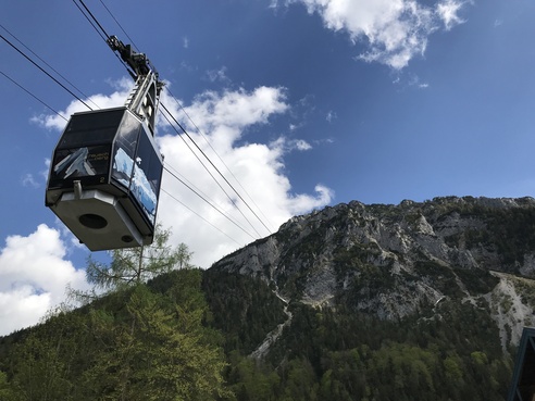
Your day will start with a private transfer from your hotel to the Bergen Hochfelln cable car station. Take in the sweeping views of the Chiemgau, the foothills of the Bavarian Alps, while the cable car makes its way up to the viewing platform.
Take a moment to admire the spectacular panorama view before embarking on your walk. The trail takes you past sprawling alpine meadows and through the heart of the forest which are akin to the more northernly forests which inspired the Grimm fairy tales, until you reach Ruhpolding, a well known winter sport resort
Info
Karte
Details
|
Kondition
|
|
|
Erlebnis
|
|
|
Landschaft
|
|
| Technik |
Beste Jahreszeit
Wegbeschreibung
Start
Bergen
Ziel
Ruhpolding
Weg
The Salzalpensteig trail is very well-signposted. Simply follow the yellow signs with green mountains on them. (See your information pack for a picture)
START at the mountain station of the panoramic Hochfelln mountain, at an altitude of 1664 metres. Your route starts on a narrow gravel path. After a few minutes, TURN LEFT and walk through the pine woodland and across the alpine meadows to Felln Alm and Farnböden Alm.
Stay on the gravel path and keep to the right. At the next clearing, BEAR LEFT and pass the beehives and TURN LEFT again shortly after the hives. Follow the narrow woodland path that will take you halfway around the Reitstein peak (1250 m). You’ll then make a steep, zig-zag descent into the woods. CONTINUE STRAIGHT until you cross over a road, then BEAR LEFT. Keep your eyes peeled to TURN RIGHT into the “fairytale forest” (Märchenwald). When exiting the Märchenwald, you’ll pass a small chapel. CROSS over the bridge and TURN LEFT into Brandner Straße; CONTINUE STRAIGHT along this road for a short while. TURN RIGHT, passing a few houses. At the fork, BEAR RIGHT then immediately TURN LEFT. You’ll find yourself back in the woodland. Follow the path past the lifts. Cross the Weingartengraben stream, BEAR RIGHT twice, then TURN LEFT into a large meadow. The trail takes you past Berggasthof Weingarten; enter the woodland behind the inn. Immediately afterwards, you’ll be back in a meadow; take the road towards Fuchsau.
In Weiler Stockreit, TURN LEFT onto a narrow path. Walk along the road for a short while then TURN LEFT again onto a gravel path. When you reach Wasen, TURN RIGHT twice and then TURN LEFT, crossing a meadow to reach Ruhpolding. Pass the ice rink and “Vita-Alpina” pool and then TURN LEFT across a wooden bridge. CONTINUE STRAIGHT along a sandy track until you reach the “am Brothaus” roundabout. ARRIVE at the tourist information centre, where this leg ends, is just 200 metres away. From Wasen, the route is marked in red with “SalzAlpenWeg” signs.
Weitere Informationen
From Hochfelln mountain station, you’ll get great panoramic views of Chiemsee lake, the Großglockner and Großvenediger peaks. If you’re lucky, you might even get to see some paragliders taking off.
The cable car ride costs €17 (one way). Your guest card will get you a €2 discount. From 09:00, the cable car departs every half an hour. Further information on the cable car can be found at: https://www.hochfelln-seilbahnen.de/startseite/
Ruhpolding is a great place to take a break: https://www.chiemsee-chiemgau.info/ruhpolding
Ausrüstung
We recommend wearing hiking boots that are well broken-in, plus a rain jacket and waterproof trousers in wet weather, as well as taking sun cream and a hat on nicer days.
In your information pack, you’ll find a detailed list of all the required hiking gear, including some good hiking boots, appropriate clothing, a rain jacket and a backpack.
Sicherheitshinweise
There are limited stops for snacks and drinks on the route Therefore you have to take enough water and provisions with you
