| Schwierigkeit |
mittel
|
|
Aufstieg
|
241 hm |
|
Abstieg
|
558 hm |
| Tiefster Punkt | 914 m |
| Höchster Punkt | 1303 m |
|
Dauer
|
5:55 h |
|
Strecke
|
14,9 km |
Walk to Mittenwald
Die Tour
A hike from Garmisch-Partenkirchen through Wamberg, around Lakes Ferchensee and Lautersee to Mittenwald.
The day starts with a leisurely hike, giving you plenty of time to warm up! The cable car will whisk you up Eckbauer Mountain, where you’ll begin your hike through Wamberg to the exquisite Schloss Elmau (unfortunately, there are no opportunities for exploring here). Following the wide gravel path, you’ll slowly make your way around Lakes Ferchensee and Lautersee before arriving into the pretty little town of Mittenwald.
Autorentipp
Make sure to try the Brettljause, a typical Austrian farmer’s dish, as you enjoy the great views at the Elmauer Alm Inn.
Info
Karte
Details
|
Kondition
|
|
|
Erlebnis
|
|
|
Landschaft
|
|
| Technik |
Beste Jahreszeit
Weiter stöbern
Wegbeschreibung
Start
Eckbauer mountain cable cars, Karl und Martin Neuner-Platz 2, 82467 Garmisch-Partenkirchen (1,226 hm)
Ziel
The church in Mittenwald on Matthias-Klotz-Straße
Weg
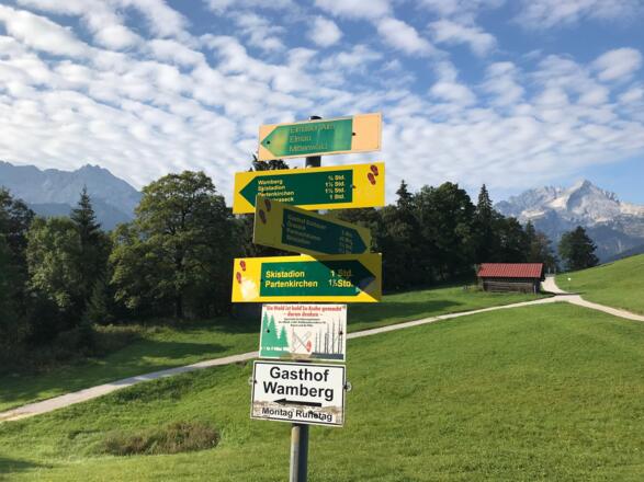
0.00km Leave the Eckbauer mountain cable cars and make a U-turn round to your LEFT. The signs will point you towards Mittenwald. Take the steps down from the cable cars and TURN LEFT. Follow the gravel path uphill and the signs towards Elmauer Alm.
0.8km Turn right at the small hut and keep following the wide gravel path. Ignore the small path that goes uphill to the left.
0.9km You’ll arrive at a crossroads. Continue STRAIGHT AHEAD up the trail and follow the signs towards Elmauer Alm over the ridges.
1.3km Keep RIGHT and go through the gate.
1.5km Keep RIGHT and continue following the gravel path.
2.0km You’ll reach a fork in the path. TURN LEFT and follow the signs to Elmauer Alm. The path leads steeply uphill.
3.9km Go through the gate and continue STRAIGHT AHEAD.
4.2km You’ll reach a T-junction. TURN LEFT and continue following the yellow signposts for Elmauer Alm.
4.5km The trail will bend to the left, TURN RIGHT and continue following the signs.
4.9km You’ll arrive at the Elmauer Alm Inn. Go left around the inn and continue STRAIGHT AHEAD over the terrace, then follow the steps that lead you onto a path that bends to the left downhill.
5.1km You’ll reach a gate that separates you from the grazing farm animals. Go through the gate and continue on the path across the meadow downhill. At the end of the meadow, you’ll go through another gate.
5.3km At the crossroads, take the path STRAIGHT AHEAD, which leads you downhill, ignoring the paths to your left and right and following the signs to Elmau.
5.4km At the next T-junction, TURN RIGHT.
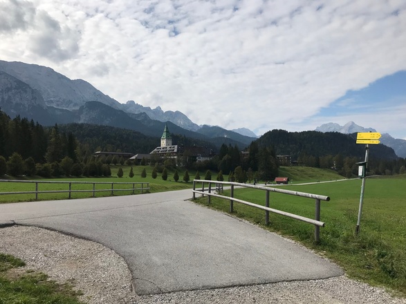
5.9km You’ll now be able to see Schloss Elmau.
6.0km Follow the gravel path, cross the small bridge and the trail will lead you uphill.
6.2km At the T-junction, TURN RIGHT.
6.3 km You’ll arrive on a paved road. TURN RIGHT and walk up to the wooden bus shelter.
6.5km TURN LEFT just before the bus shelter.
6.7km Schloss Elmau is on your right. Following the signs to Mittenwald, continue STRAIGHT AHEAD.
7.3km Continue STRAIGHT AHEAD on the wide gravel path. Ignore the paths that branch off to your left and right and continue following the signs to Mittenwald.
7.4km Take the footpath towards Mittenwald, which is the smaller path to your RIGHT at the fork in the road. You’ll now be walking alongside the Ferchenbach river, with the river on your left.
8.2km KEEP RIGHT and follow the wide gravel path once again. On your left you’ll see a covered bench.
9.3km You’ll arrive at a crossroads. KEEP LEFT and follow the signs to Mittenwald, Ferchensee and Lautersee. To your right you’ll see a fenced-off fish pond. Continue STRAIGHT AHEAD.
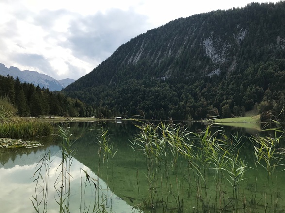
10.2km Keep going STRAIGHT AHEAD when you reach the hut by Lake Ferchensee. At the Lake Ferchensee beer garden, continue straight ahead or, alternatively, enjoy a walk around the lake. If you continue straight ahead, keep the lake on your right-hand side.
10.7km At the fork in the path, take the smaller, lower path by the lake and follow the signs for Mittenwald.
10.8km Keep LEFT and follow the gravel path uphill and the signs for Mittenwald. Leave the lake behind you.
11.1km You’ll arrive at a crossroads. Continue STRAIGHT AHEAD and follow the white/red signs.
11.4km At the fork in the path, keep LEFT and follow the signposts.
11.5km You’ll cross a paved road. On your right, you’ll see a covered bench. Continue on the gravel path keeping RIGHT. Keep following the signs.
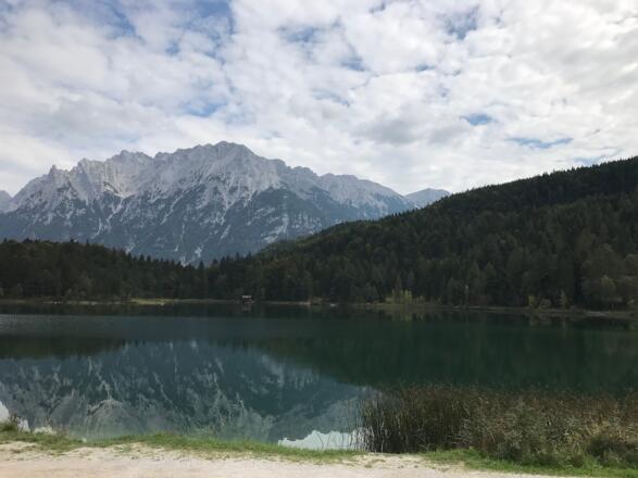
11.8km Keep RIGHT at the fork in the path. On your right you’ll see an information board and you’ll be able to see Lake Lautersee straight ahead.
12.1km You’ll arrive at Lake Lautersee. The lake will be on your right.
12.2km Continue STRAIGHT AHEAD on the gravel path between the houses.
12.6km You’ll cross a small bridge. Continue STRAIGHT AHEAD. You will now be facing a church. TURN RIGHT and follow the signs.
12.8km At the Y-fork in the path, KEEP LEFT and continue STRAIGHT AHEAD. Follow the signs to Mittenwald via Latscheneck. Take the path to your LEFT, which leads you uphill.
13.2km On your left you’ll see a bench. Next to it, you’ll see a tree with a sign saying "Bödele Am Knausner Graben”. Straight ahead will be a well. Follow the path around to the RIGHT towards the well and over a small bridge.
13.8km Follow the right-hand bend. On your left you’ll see the rock garden viewpoint. Then follow the left-hand bend.
14.0km Continue STRAIGHT AHEAD and ignore the path leading down to the viewpoint over Mittenwald to your right.
14.1km At the fork in the path, keep RIGHT and follow the signs downhill towards Mittenwald. The path now leads you downhill in a zig-zag fashion towards Mittenwald.
14.5km You’ll arrive in Mittenwald. Follow the paved road downhill (Klausnerweg) STRAIGHT AHEAD.
14.6km A house with yellow artwork on it will be in front of you. At the T-junction, TURN RIGHT and continue straight ahead. On your right, you’ll see the Gasthof Gries Inn.
14.9km Walking straight ahead, you’ll reach the church in Mittenwald. You’ve completed your hike for today.
Anreise
Öffentliche Verkehrsmittel
The Eckbauer Bergbahn can be found next to the Olympia Ski Stadium in Garmisch-Partenkirchen. Buses no. 1 and 2 stop there regularly. Timetables can be found (in German) here: https://www.gw-gap.de/ortsbus/fahrplanauskunft Your accommodation provider will also be able to help you with this information. Information about the Eckbauer Bergbahn can be found here: https://www.eckbauerbahn.de/
Weitere Informationen
Operating times and prices for the Eckbauer mountain cable cars can be found at http://www.eckbauerbahn.de/
Please note the Elmauer Alm Inn is closed on Mondays and Tuesdays, while short term closures are also possible during bad weather. Make sure to take plenty of food and water just in case so you’re well-stocked for the first few kilometres.
Schloss Elmau is now a hotel and only open to guests. If you would like to take a break at Schloss Elmau, you must book ahead to dine in the café or restaurant. Further information is available at https://www.schloss-elmau.de/
There are places to stop for a rest or picnic around Lakes Ferchensee and Lautersee.
Ausrüstung
We recommend wearing hiking boots that are well broken-in, plus a rain jacket and waterproof trousers in wet weather, as well as taking sun cream and a hat on nicer days.
In your information pack, you’ll find a detailed list of all the required hiking gear, including some good hiking boots, appropriate clothing, a rain jacket and a backpack.
Sicherheitshinweise
Today you may be walking past a few different areas where cows graze. Although generally very docile and used to walkers, keep your distance and never turn your back on a cow that is behaving strangely or aggressive. Be particularly vigilant around cows with calves.
Keep a close eye on the weather forecast. In the mountains, the weather can change very quickly. Do not stay in the mountains during thunderstorms.


