|
Aufstieg
|
37 hm |
|
Abstieg
|
1 hm |
| Tiefster Punkt | 656 m |
| Höchster Punkt | 692 m |
|
Dauer
|
1:20 h |
|
Strecke
|
5,2 km |
Ruhpolding to Inzell via Rauschberg - Part 1

Foto: Minna Harshbarger, Macs Adventure
Die Tour
Salzalpensteig Alternative Stage: Ruhpolding to Inzell PART 1 (to the Upper Rauschberg Cable Car Station)
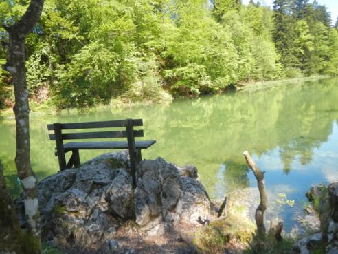
A scenic hike awaits as you walk from Ruhpolding to Inzell in the Chiemgau Alps. At the foot of the Rauschberg mountain (1645m), reach the picturesque Taubensee and on to the Rauschberg Cable Car Station
Autorentipp
Check if the Rauschbergbahn Cable Car is running as it only runs in good weather conditions - www.rauschbergbahn.com
Info
Karte
Wegbeschreibung
Start
Tourist Information Centre in Ruhpolding
Ziel
Rauschbergbahn Cable Car Station
Weg
START at the Tourist Information Centre in Ruhpolding, with your back to the centre TURN RIGHT and walk along the street to a roundabout, where you take the first junction on the right. TURN RIGHT on to a small sandy path that leads over a wooden bridge and past an indoor swimming pool called "Vita-Alpina". From here CONTINUE to the village of Wasen. When you arrive in Wasen, TURN RIGHT and then TURN LEFT.
You will reach a narrow meadow path, follow the path as it CROSSES large fields to Fuchsau. The path turns into an asphalt road, BEAR LEFT as you reach Fuchsau. PASS the enchanting Fuxwagner chapel on your left. CONTINUE STRAIGHT, and CROSS the bridge over the Weisse Traun river. BEAR RIGHT and follow the path to the right that leads along the river towards Taubensee Lake.
Follow the gravel path, CROSS the main road again and a little later TURN LEFT into the forest. In the forest, TURN RIGHT and then LEFT along the "Taubenseerundweg" path, and you will reach the eastern bank of the Taubensee Lake. After you have half circled the lake, keep to the left and you will reach the valley station of the Rauschbergbahn Cable Car. Please note that this is only in operation in good weather conditions.
Weitere Informationen
Ausrüstung
We recommend wearing hiking boots that are well broken-in, plus a rain jacket and waterproof trousers in wet weather, as well as taking sun cream and a hat on nicer days.
In your information pack, you’ll find a detailed list of all the required hiking gear, including some good hiking boots, appropriate clothing, a rain jacket and a backpack.
Sicherheitshinweise
Today you may be walking past a few different areas where cows graze. Although generally very docile and used to walkers, keep your distance and never turn your back on a cow that is behaving strangely or aggressive. Be particularly vigilant around cows with calves.
Watch the short term local weather forecasts. Avoid high altitude hiking when the weather is bad. There are plenty of trails in the valleys, that allow you to reach a village quickly if bad weather sets in.
