| Schwierigkeit |
mittel
|
|
Aufstieg
|
236 hm |
|
Abstieg
|
302 hm |
| Tiefster Punkt | 733 m |
| Höchster Punkt | 886 m |
|
Dauer
|
8:00 h |
|
Strecke
|
27,6 km |
Wildsteig (or Steingaden) to Buching
Die Tour
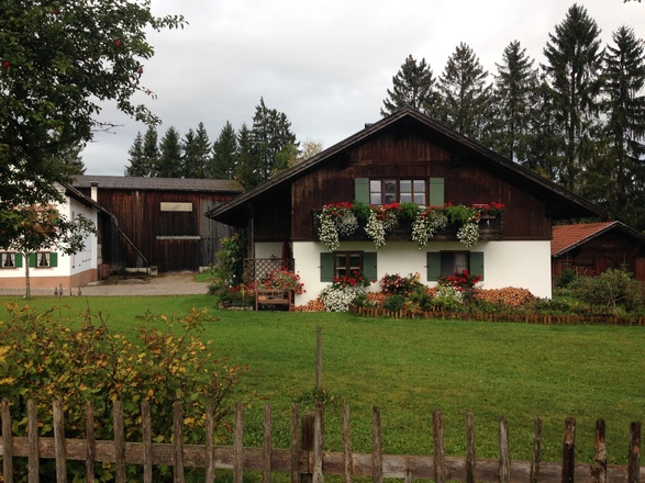
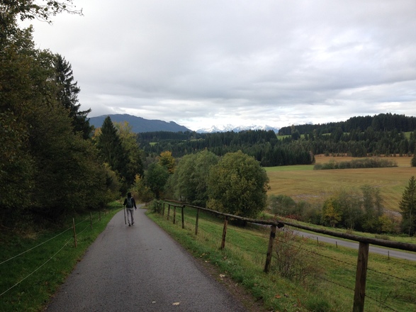
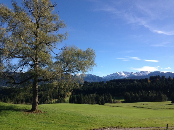
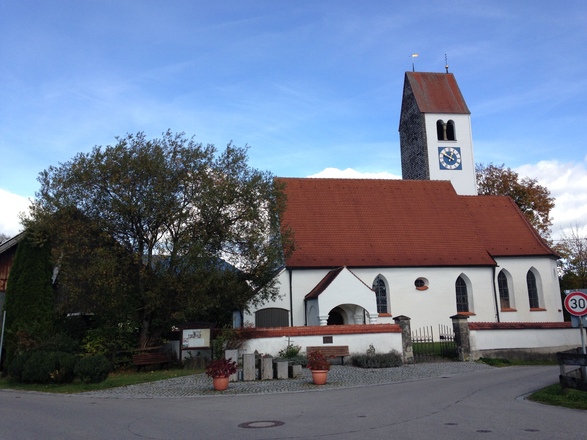
Cross meadows with Alpine views, before reaching the UNESCO Site of Wieskirche, a baroque masterpiece of space and light with magnificent frescoes, before walking to Buching.
Today you can choose between two variants of the King Ludwig Way; a slightly shorter route via the Bavarian villages of the Trauchgau, or a longer walk across moorland and via Steingaden. These directions follow the route via Steingaden. NOTE: if you stayed in Steingaden last night instead of Wildsteig, you will follow this trail by default and you should follow the turn by turn directions from 9.8km. If you spent last night in Peiting, your included taxi transfer will bring you to the trailhead in Wildsteig where you will continue the walk to Buching, following either the route via Steingaden as detailed here, or the shorter route via Trauchgau (the turning point of which is at approx. 5.5km along this trail and is mentioned in the turn by turn directions).
Although today's walk via Steingaden is the longer one, it doesn't involve a lot of ascent - in fact there is more descent than ascent. You'll pass through a lot of forest land and some scenic pastureland. As with other days, way-marking of the route is generally good. However, it is a bit less plentiful after Steingaden. Note that you will need to leave the KLW near the end of the route to get to Buching.
There are few shops on route to buy food and drink. Make sure to bring plenty of water for the day's walk. There are also a number of restaurants and cafés enroute at Wies, Steingaden, Urspring and Prem.
Info
Karte
Details
|
Kondition
|
|
|
Erlebnis
|
|
|
Landschaft
|
|
| Technik |
Weiter stöbern
Wegbeschreibung
Start
Wildsteig
Ziel
Buching
Weg
0.00 km - Standing outside the front door of Hotel Zur Post, BEAR LEFT and walk down the road, following the K signs. Continue downhill to a T junction.
0.40 km - TURN LEFT and continue downhill over a crossroads to reach a turning on the right.
1.00 km - TURN RIGHT into a no-through road, following the K sign to Wallfahrtskirche Wies. Pass houses and a very small church to your right to reach a T junction.
1.50 km - TURN LEFT and continue downhill to a turning on your right.
1.70 km - TURN RIGHT following the sign to ‘Wallfahrtskirche Wies 3.7K’. Cross a stream and continue uphill to a 4-way crossing.
2.40 km - TURN LEFT (not the very sharp left) following the wooden sign to Wies. Carry on towards the forest to a 4-way crossing at the edge of the forest.
2.60 km - TURN LEFT downhill through dense forest and continue to a 4-way crossing in a clearing.
2.80 km - Go STRAIGHT ON and then cross a stream to reach a T junction.
2.90 km - TURN LEFT following the K sign to ‘Wallfahrtskirche Wies 2.5K’. Carry on along a gravel track to reach a T junction.
3.40 km - TURN LEFT and continue through a forest to another T junction.
4.40 km - TURN RIGHT onto an asphalt road and exit the forest to find a conference centre on your right.Carry on to the entrance of the conference centre where you will see a path to your left.
4.60 km - TURN LEFT onto a footpath following the K sign to ‘Wallfahrtskirche Wies 1.0K’. Continue on the path, alongside a line of trees to your right, to reach a single track road.
5.20 km - Turn RIGHT onto road and walk downhill to three way crossing.
5.40 km - Go STRAIGHT ON towards Weis church. Carry on to the tiny church on left and way marker on right.
5.50 km - TURN RIGHT following the K sign to ‘Steingaden 4.9K’. Follow the road past souvenir shops on your left and an Inn on your right around to a farmyard at the back of the Inn. Then continue to a turnstile at edge of a field.ALTERNATIVELY TURN LEFT and follow the K sign to Trauchgau (a shorter way to Buching).
5.70 km - Go STRAIGHT ON through a turnstile on a path through a field, with the forest to your right.Pass through another turnstile and continue on a path through forest and marshland, along planks. Carry on, following the K signs (and small yellow ST2 signs) to reach a track.
7.90 km - TURN RIGHT onto a track and continue to a turning on your left.
8.30 km - TURN LEFT, following the K sign to Steingaden, through forest downhill to a footbridge over river.Carry on, with a stream to your right, on a path through fields to then cross a bridge.
9.80 km - Go STRAIGHT ON following a sign to ‘Steingaden 2.1K’.Carry on along a track, with the river to your left. The track gives way to an asphalt road as you enter the residential area of Steingaden. Continue to a T junction.
11.00 km - TURN RIGHT and continue past the Fischerhaus on your right to reach a bridge.
11.40 km - TURN RIGHT just before the bridge onto a path alongside a brook (to your left and then right).Carry on through a timber mill to find a crucifix by a bench and way marker.
11.70 km - Go STRAIGHT ON following the K sign to ‘Steingaden 0.5K’ along Welfenstrasse. Pass by taverns to your left and the church to your right. Then go through an arch and bear left, passing Gasthof Zur Post on the right, and make your way to a main road.
12.30 km - Go STRAIGHT ON over a pedestrian crossing and follow the K sign to ‘Prem 7.1K’.Walk alongside a stream to your left. Then cross a bridge and follow the stream to your right. Continue along a residential road until you come to a crucifix at a fork in the road.
13.10 km - FORK LEFT and carry on uphill leaving the residential area of Steingaden.Walk through the open countryside, with views back over Steingaden and the mountains in the distance ahead. Continue to the edge of the village of Urspring.
14.20 km - Go STRAIGHT ON following the K sign to ‘Prem 5.4K’. Continue through Urspring over a crossroads and on to a T junction.
14.50 km - TURN RIGHT at a T junction and continue to a crossroad with church to your right.
14.70 km - TURN LEFT following the K sign to ‘Prem 4.9K’. Carry on out of the village to a T junction at busy road.
15.00 km - TURN RIGHT and continue alongside a busy road to the first turning on your left.
15.10 km -TURN LEFT onto a minor road and carry on to a T junction at edge of village of Steingadele.
15.70 km - TURN RIGHT following the K sign to ‘Prem 3.9K’. Carry on through the village to a fork in the road.
15.90 km - FORK RIGHT and continue on a road winding through fields to reach a turning on your left.
16.40 km - TURN LEFT following the K sign and continue over a bridge to a track at the edge of a forest.
16.50 km - TURN RIGHT and walk along a track, alongside a brook to your right to reach a T junction with a bridge to your right.
17.10 km - TURN LEFT and continue on a track through the forest. Continue, as the track becomes path, through forest and then through a field, where it becomes a track again.Carry on to reach the edge of Prem. Then walk along the residential street of Moorweg to reach a T junction
18.90 km - TURN LEFT following the K sign to reach a staggered crossroad
19.60 km - TURN RIGHT and carry on past the church to your left. Then continue downhill to reach a T junction.
20.30 km - TURN RIGHT at a T junctionand then TURN LEFT just before the tourist information office. Then go over a bridge and then over another (smaller) bridge to walk on a path through forest to reach a track with a football pitch in front of you.
20.70 km - TURN RIGHT onto a track. Continue to a T junction.
20.80 km - TURN LEFT at the next T junction,then TURN RIGHT at the next,then TURN LEFT at the nextand TURN RIGHT at the next.Finally reach a way marker at the side of the reservoir and TURN LEFT to walk along path with reservoir to your right.
ALTERNATIVELY just walk towards the big grassy bank ahead of you and clamber up it to reach path alongside the reservoir and TURN LEFT onto it at the top.
21.30 km - Go STRAIGHT ON alongside the reservoir to your right. Carry along on a gravel track, turning away from the reservoir into forest. Continue to reach a road.
23.40 km - TURN RIGHT following the K sign to ‘Ostern 25mins’. Continue uphill to road turning on the right.
23.70 km - TURN RIGHT and cross a bridge over the river. Continue on a road to a turning on the left.
23.90 km - TURN LEFT and continue on a windy scenic road to the village of Ostern and then downhill to a T junction in the village of Thal.
24.80 km - TURN LEFT and continue to a busy road.
25.30 km - TURN LEFT, after crossing the busy road, and continue along the cycle/footpath. Continue all the way to the end of the path.
26.00 km - Go STRAIGHT ON along footpath on the other side of the road. Carry on downhill until you come to an inconspicuous staggered crossroad. DON'T MISS IT!!It has a list of hotels on a sign to the right and a small yellow and green bus stop, also to the right. There is also a very unobtrusive way marker on the road to the left.
26.50 km - TURN RIGHT and go downhill on a quiet road, passing a church on your right.Then leave Berghof and continue STRAIGHT ON over several crossroads to then enter Buching. Carry on until you come to a crossroad with Romantische Strasse to your left and Fussener Strasse to your right.
27.60 km - ARRIVE at the centre of Buching.TURN LEFT to find hotel Alpchalet 100m on your right (please check your accommodation list to see where you are staying).
Weitere Informationen
There are few shops on route to buy food and drink. You would be well advised to fill your water flask before leaving. There are however a number of restaurants and cafés en route at Wies, Steingaden, Urspring and Prem.
Alternative Transport: Bus from Wildsteig via Wies and Steingaden to Buching (number 73, approx. 20 mins, see http://fahrplan-bus-bahn.de/bayern/fuessen/bus_linie_bus_73)
Points of Interest:
Wies Church - see: http://www.wieskirche.de/eframset.htm
Marshland between Wies and Steingaden; boardwalks for pedestrian to cross.
Forest near Prem; declared a 'Lebensraum fur Mensch und Tier' (habitat for humans and animals). Some interesting wood carvings can be found here.
Reservoir between Prem and Ostern; a large expanse of water that fits well into the landscape.
Area around Ostern; which boasts some of the most scenic walking of the whole trip.


