| Schwierigkeit |
mittel
|
|
Aufstieg
|
418 hm |
|
Abstieg
|
406 hm |
| Tiefster Punkt | 671 m |
| Höchster Punkt | 980 m |
|
Dauer
|
6:30 h |
|
Strecke
|
22,5 km |
Wessobrunn (or Paterzell) to Peiting
Die Tour
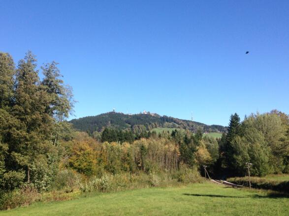
Pass sleepy villages to the base of Hoher Peissenberg (3261 ft). From the summit you can continue on foot down to pretty Peiting, or take the train shortening the walk by 6km.
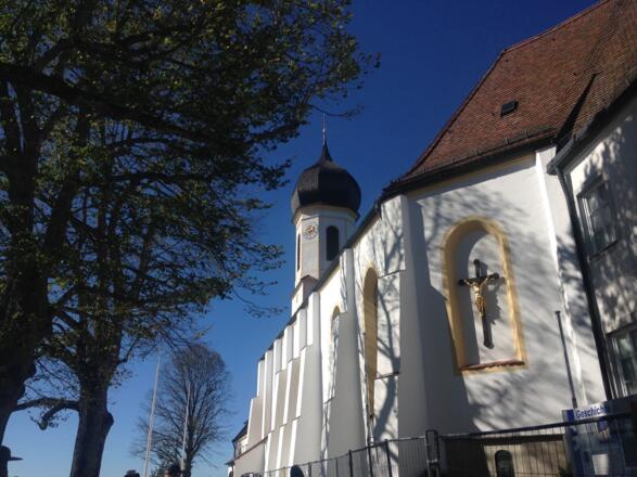
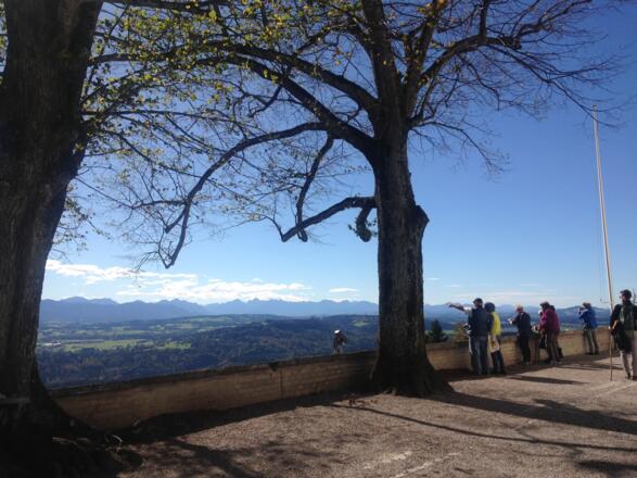
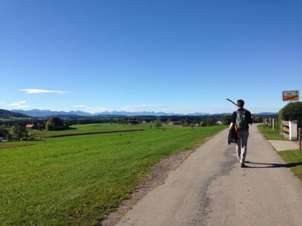
This route passes through the forests and pastureland of the Pfaffenwinkel region, much-loved by King Ludwig. Though the pilgrim church at Hohenpeissenberg is at almost 1000 m above sea level, where you'll get great views over the countryside on a clear day.
The route can be shortened by 6 km by taking a train (payable locally) from Hohenpeissenberg, after you have descended from the mountain. However, this last part of the hike, alongside the railway to Peiting, is peaceful, scenic and largely on flat ground making progress very easy.
There are few shops on route to buy food and drink. Make sure to bring plenty of water for the day's walking. There is an inn next to the pilgrim church at Hohenpeissenberg - a good place to have lunch.
Info
Karte
Details
|
Kondition
|
|
|
Erlebnis
|
|
|
Landschaft
|
Weiter stöbern
Wegbeschreibung
Start
Wessobrunn (or Praterzell)
Ziel
Peiting
Weg
If you spent last night in Praterzell, retrace your steps from yesterday out of Praterzell back to the forest path and the KLW. Bear left at the junction in the forest to continue to Peiting. You can then follow the below instructions from 5.30km. We recommend using our app to easily navigate yourself back to the trail. If you spent last night in Wessobrunn, please follow instructions from 0.00km.
0.00km - Standing at the way marker in the monastery square with your back to the clock tower, go STRAIGHT ON following the K sign to ‘Hohenpeissenberg 15.6K’.Carry on to the main road.
0.10 km - BEAR LEFT at the main road and go downhill then uphill through Wessobrunn.Continue until you come to a minor road turning on your right, with a small wooden sign for Forst-St. Leonard.
0.80 km - BEAR RIGHT onto the minor road following the K sign.Continue on to the residential road to a wooden shelter.
1.00 km - BEAR RIGHT turning off of the road onto an asphalt track heading towards the countryside.
1.20 km - TURN LEFT following the K sign for ‘Hohenpeissenberg 15.0K’.Go past a recycling centre to a football pitch, to your left.
1.40 km - TURN RIGHT and head downhill on a track into the forest following a wooden sign for Paterzell. Carry on to a path on the right.
1.50 km - BEAR RIGHT onto a path following the K sign and wooden sign for ‘Paterzell’.Continue downhill through the forest. Then cross a footbridge over a stream and carry on uphill on the path to reach the track.
1.80 km - TURN LEFT following a wooden sign to Paterzell and the K sign. Continue uphill on a track through the forest to a T junction.
2.30 km - TURN LEFT and carry on up and down the hill through the forest to another T junction.
2.70 km - TURN RIGHT following the K sign and wooden sign to ‘Paterzell’ to reach a crossroads.
2.90 km - Cross the road, go STRAIGHT ON and continue on the asphalt track uphill through fields.Carry on until you see a barn on your right.
3.10 km - TURN LEFT at the barn onto a footpath following the K sign to ‘Hohenpeissenberg 12.9K’. Continue to the track.
3.20 km - TURN RIGHT onto a track and continue to a T junction.
4.40 km - TURN LEFT at a T junction following a wooden sign for ‘Paterzell’ along a track through the forest to reach another T junction.
4.70 km - TURN RIGHT and continue through the forest past turnings to the left and right.Carry on until you come to a multi-directional signpost on your right.
5.30 km - BEAR RIGHT off of the track onto a footpath following the K sign to ‘Hohenpeissenberg 11.8K’. Continue to the track.
5.60 km - TURN RIGHT onto a track and continue to reach the steps.
5.90 km - Go STRAIGHT ON up the steps to then leave the forest. Then continue along a path through the field to reach a single track road.
6.20 km - TURN LEFT onto a road following the K sign and green sign for St Leonards. Continue on the road to a turning on the left.
6.30 km - TURN LEFT towards the farm building and continue to the track crossing.
6.40 km - TURN LEFT at the track junction following the K sign. Continue to a fork in road.
6.60 km - FORK RIGHT and continue towards a farm in the near distance.
7.20 km - TURN RIGHT on reaching the farm, following the K sign to ‘Hohenpeissenberg 10.2K’.Carry on along a winding asphalt track through fields. Then continue into Forst to reach a T junction
8.20 km - TURN LEFT at a T junction and continue past a timber mill to your right. Carry on to another T junction.
8.40 km - TURN RIGHT and carry on to yet another T junction (where you will see the town church to your right).
8.60 km - TURN LEFT and continue on the side of road (which can be busy). Carry on uphill to a turning and farm on your right.
9.10 km - TURN RIGHT, following the K sign to ‘Hohenpeissenberg 8.4K’.Leave Forst and continue on a windy road through fields to Hof.Carry on until you come to a crucifix at a fork in the road.
9.90 km - FORK RIGHT following the K sign and continue to a T junction.
10.00 km - TURN LEFT at a T junction and continue along a meandering road through fields to a crossroads.
10.60 km - TURN RIGHT following the K sign to ‘Hohenpeissenberg 7.0K’ on a windy road through fields towards the forest.Carry on to a fork in the road.
11.00 km - FORK LEFT following the K sign and continue on the road through a field and then through pine forest to reach another fork in the road.
11.60 km - FORK RIGHT and carry on downhill and then on a straight track through swampy forest until you eventually come to a T junction.
13.20 km - TURN LEFT following the K sign to ‘Hohenpeissenberg 4.5K’.Carry straight on to eventually leave the forest, with views of the Hohenpeissenberg Pilgrim Church on the hill/mount ahead of you. Carry on to the turning on the right.
14.20 km - Go STRAIGHT ON at the turning to the right following the K sign to ‘Hohenpeissenberg 2.7K’. Continue to a T junction.
14.60 km - TURN RIGHT following the K sign. Now look out for Oberfeldstrasse on your left.
14.80 km - TURN LEFT onto Oberfeldstrasse (there are no K signs here).Continue straight on over a crossroads in this residential area to reach a field in front of you.
15.10 km - BEAR slightly LEFT and walk across the field to the footpath at the edge of the forest on the other side of the field (following the K sign for ‘Hohenpeissenberg 1.4K’).
15.30 km - Go STRAIGHT ON up the steep path through a forest following the K signs.Carry on passing a shrine and small picture depicting children bringing flowers to the Virgin Mary and Jenny Wood's memorial plaque.Eventually arrive at a way marker in front of the pilgrim church.
15.70 km - BEAR RIGHT and walk past the church to your left to the next way marker.
15.90 km - BEAR RIGHT, following the K sign, along a narrow path which leads past the weather centre, to your right, and then go steeply downhill through the forest. Continue to the edge of the forest.
16.60 km - Go STRAIGHT ON across the field to a track and way marker.
17.70 km - TURN RIGHT onto a track and continue to the road.
17.80 km - TURN LEFT onto a road and continue on the road winding down to a busy main road in front of you.
18.10 km - Go STRAIGHT ON crossing the busy road and continue downhill into Anton-Probstl-Strasse.Continue past a football pitch on your right to a point where the road bends to the left.
18.40 km - TURN RIGHT, following the K sign, onto a track across fields passing a barn to your right (don't take the other track passing the other side of the barn).The track then turns left and then after winding a bit more brings you to a road.
19.00 km - TURN RIGHT onto a road following the K sign to ‘Rottenbuch 12.1K’. Now continue to the second turning on your left.ALTERNATIVELY - turn left and then take the first right to get to Hohenpeissenberg train station (about 0.5K from here). From the station you can take the train to Peiting Ost.
19.50 km - TURN LEFT following the K sign. Pass under a bridge carrying a new road (not yet open). Carry on and continue through fields, interspersed with patches of forest.Then cross over the single track railway and continue to reach a T junction.
19.60 km - TURN RIGHT following the K sign to ‘Rottenbuch 10.6K’.Carry on to reach a level crossing (where the KLW trail turns to the left).
20.20 km - Go STRAIGHT ON (leaving the KLW trail) over the railway.and then immediately TURN LEFT at the T junction ahead of you. Continue on the road with the railway to your left and then go on over another level crossing. Carry on until you come to a T junction.
21.00 km - TURN RIGHT following the sign for ‘Peiting Mitte 2.9K’.Carry on along this road all the way to Peiting Ost train station.The road crosses over a major highway, then passes alongside the railway, turning away from it for a while before then running alongside the railway again. Continue to a big yellow building on your right, which is Peiting Ost station.
22.50 km - ARRIVE at Peiting Ost Station.
Weitere Informationen
There are few shops on route to buy food and drink. You would be well advised to fill your water flask before leaving. There is an Inn next to the pilgrim church at Hohenpeissenberg; possibly a good place to have lunch
Alternative Transport - Train from Hohenpeissenberg to Peiting Ost (6 mins, see www.bahn.co.uk for timetables)
Points of Interest
On the climb to the pilgrimage church of Hohenpeissenberg you will find shrines, paintings and a memorial plaque to Jenny Wood.
At the top of the climb above Hohenpeissenberg you can visit the pilgrim church and enjoy refreshments in the nearby Inn. You can also take in the view and read about the neighbouring weather station.
Peiting Church of Wallfahrtskapelle Maria Egg on Bahnhofstrasse (near the train station); this church contains a lovely picture-by-picture story of the pilgrim tale about the son hanged at a gibbet and the chicken on a plate both coming back to life.
Ausrüstung
A sturdy pair of walking trainers are adequate for this route if you don't wish to wear hiking boots.
