| Schwierigkeit |
mittel
|
|
Aufstieg
|
389 hm |
|
Abstieg
|
1305 hm |
| Tiefster Punkt | 659 m |
| Höchster Punkt | 1601 m |
|
Dauer
|
5:10 h |
|
Strecke
|
13,5 km |
Walk to Walchsee

Foto: Sarah Stone, Macs Adventure
Die Tour
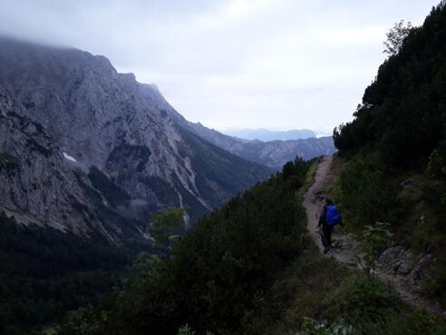
Via a high trail, walk through beautiful mountain vistas to the ’Hochalm zum Heuberg’, where you will catch a first glimpse of the Walchsee in the distance. Descend steeply to the scenic Walchsee, where you will be staying for the next two nights.
After enjoying watching the sunrise from the terrace of the Stripsenjochhaus with a fortifying coffee, continue on your adventure via a high trail, walk through beautiful mountain vistas to the ’Hochalm zum Heuberg’, where you will catch a first glimpse of the Walchsee in the distance. Descend steeply to the scenic Walchsee, where you will be staying for the next two nights.
Info
Karte
Details
|
Kondition
|
|
|
Erlebnis
|
|
|
Landschaft
|
|
| Technik |
Beste Jahreszeit
Wegbeschreibung
Start
Stripsenjochhaus (1574 m)
Ziel
Walchsee – Durchholzen
Weg
0.0 km - Walk behind the Stripsenjochhaus between the buildings until you reach the signpost. At the signpost turn LEFT towards Walchsee and follow the Höhenweg past the Stripsenkopf.
1.0 km - At the bend in the ridge turn RIGHT and follow the path downhill over the meadows towards Zahmer Kaiser/Ropanzen.
1.7 km - At the crossroads at the bottom of the valley follow the signposting to Hochalm STRAIGHT AHEAD up the mountain (Ropanzen).
Be careful! When wet, it can be very muddy and slippery on the steep ascent!
2.5 km - Go over the hilltop and follow the signposts to Hochalm STRAIGHT AHEAD.
3.1 km - At the Hochalm continue to walk STRAIGHT AHEAD towards the Zahmen Kaiser (signpost Jörchl/Hageralm/Durchholzen). At the next fork, keep RIGHT towards Hageralm/Walchsee and follow the red and white trail markings.
4.0 km - At the Kleinmoseralm turn LEFT at the signpost behind the hut (direction Durchholzen/Heuberg) and follow the high trail until just before the Hageralm.
5.6 km - Just before the Hageralm turn sharp LEFT at the signpost and follow the narrow path along the slope towards Heuberg/Durchholzen.
6.2 km - You reach the Jöchl am Heuberg. Here you turn LEFT again uphill (direction Heuberg/Durchholzen) and then you go STRAIGHT OUT over the ridge and the gate downhill again. Here you have the possibility to climb the Heuberg to the right.
6.7 km - You will pass the unmanaged Jöchlalm.
7.3 km - Shortly before the Winkelalm turn RIGHT and follow the path further towards the valley. (Do not go as far as the Winkelalm.)
7.5 km - At the next crossroads turn RIGHT again and continue downhill towards Durchholzen.
8.1 km - After leaving the pasture via the turnstile at the gate, cross the road and follow the trail STRAIGHT towards the valley.
10.3 km - At the entrance to Durchholzen KEEP on the left bank of the river along the road with the blue lanterns.
10.9 km - At the crossroads in the centre of the village, turn RIGHT onto the Walchsee Bundesstraße.
11.2 km - At the next junction, turn LEFT into Sonnleiten Straße.
11.6 km - At Garni Tirol you have reached today's destination.
If you are staying in Walchsee Ort, you can either walk the 3 km further to Walchsee (on the pedestrian path along the Walchsee Bundesstraße) or you can take the bus, which usually leaves once an hour (stop Walchsee Durchholzen - stop Walchsee Dorfplatz, approx. 5 min., payable on site, timetable under https://fahrplan.vvt.at)
Weitere Informationen
Zahmer and Wilder Kaiser
The Zahmer Kaiser and Wilder Kaiser are the two main ridges that make up the Kaisergebirge mountain range. The Zahmer Kaiser is less rugged in appearance than the Wilder Kaiser and has lower peaks. The two ridges are separated in the west by the Kaisertal valley and in the east by the Kaiserbachtal. The massifs are connected between these two valleys by the Stripsenjoch Pass (1,577 m).
Stripsenjochhaus
Perched on high like a castle, the Stripsenjochhaus mountain hut is located on the Stripsenjoch Pass where the Kaiserbachtal crosses into the Kaisertal valley. It also forms a bridge between the Wilder and Zahmer Kaiser ridges, its key location earning it the nickname “the turntable”, a kind of alpine traffic hub. From the terrace of the Stripsenjoch it’s possible to see climbers on the sheer rock faces directly opposite. With over 40 mountain peaks to explore, and tours to suit all levels of expertise, it comes as no surprise that the Kaisergebirge has become a mecca for countless climbers. Since as far back as the 19th century mountaineers have looked for new routes up the Wilder Kaiser. And in all weathers too!
Ausrüstung
Always wear good walking boots with a robust sole, and take waterproofs with you. Take plenty of water with you (min. 1 litre) and don’t forget sunscreen!
Sicherheitshinweise
Today you may be walking past a few different areas where cows graze. Although generally very docile and used to walkers, keep your distance and never turn your back on a cow that is behaving strangely or aggressive. Be particularly vigilant around cows with calves.
Always allow plenty of time for your hike. The specified walking times only refer to actual time spent walking. Breaks for photos and a rest need to be added to the specified times.
Make sure you find out about current weather conditions and keep an eye on weather changes. Thunderstorms can gather very quickly in the Alps.
Do not leave the designated hiking trails!
