|
Aufstieg
|
1216 hm |
|
Abstieg
|
650 hm |
| Tiefster Punkt | 1202 m |
| Höchster Punkt | 1842 m |
|
Dauer
|
6:00 h |
|
Strecke
|
16,4 km |
Walk to the Karwendelhaus

Foto: Minna Harshbarger, Macs Adventure
Die Tour
Walkthrough the dramatic mountains to the Karwendelhaus Hut
The trip continues through the dramatic mountains, from Almdorf walking along high trails, past the almost vertical Laliderer mountain faces to the Falkenhütte. It is the perfect place to rest your legs before taking on the final stretch of today's walk. Hiking leisurely through the lofty mountain forest to the Kleiner Ahornboden and finally through sparse pine trees to the Karwendelhaus, a meeting place for mountaineers situated directly below the Bikarspitze summit.
Autorentipp
In the shop next to the hotel and in the farm store in Almdorf you can buy delicious alpine cheese and fresh alpine products for your picnic
Info
Karte
Wegbeschreibung
Start
Mountain Inn Eng-Alm
Ziel
Karwendelhaus
Weg
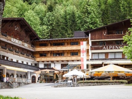
0.0 km – START from the Alpine Inn Eng, TURN LEFT, through the large archway with the inscription "Eng-Alm" - towards the steep rock walls. CONTINUE STRAIGHT along the paved hiking trail towards the house of the alpine village Eng-Alm.
0.6 km - Just before the Almendorf village, CROSS the stream. Behind the stream TURN LEFT. Pass rustic alpine pastures and the Eng-Alm farm store. CONTINUE STRAIGHT towards the Engalm guesthouse.
1.0 km - At the Engalm guest house, follow the signs for Falkenhütte (trail no. 201) with the Alderweg sticker on it. Follow this trail STRAIGHT, at first. PASS through the fence by the playground, TURN RIGHT onto the hiking trail that goes via switchbacks across a meadow ascending into the forest.
4.1 km - Reach Hohljoch. Go THROUGH the gate and BEAR LEFT towards the Falkenhütte (trail 201), spot it on the opposite hill. Follow the wide gravel path which descends along switchbacks
At the next fork, TURN LEFT, direction Falkenhütte. Walk along a narrow path over a scree slope towards Falkenhütte and Spielisshoch.
6.5 km - Reach the Spiellissjoch. Go THROUGH the gate and further along a wide scree path. BEAR RIGHT towards the Falkenhütte and onto a gravel path. After a few hairpin bends, in about 15 min, REACH the Falkenhütte. The Falkenalm is the only place to stop for refreshments today.
7km - Walk past the Falkenhütte and another building, then CONTINUE STRAIGHT on a narrow hiking trail, descending across an alpine meadow. After about 1km reach a wide gravel path. BEAR RIGHT and descend on the gravel path to the Ladizalmen. Pass the Ladizalmen and continue to follow the wide gravel path as it descends.
9.4 km - At a bend, a narrow forest path, TURN LEFT towards the Karwendelhaus (path no. 201). The shady path makes its way through the mountain forest. At the end of the forest go THROUGH a gate and keep LEFT as below you is a large scree gully.
11.2 km - When the trail ends, TURN RIGHT and cross the scree gully without a path. On the other side reach the forest again and the path (no signposting here) now leads in an arc to the Kleiner Ahornboden. CROSS a small wooden bridge onto a road and TURN LEFT towards the Karwendelhaus.
11.8 - At the crossroads at Kleiner Ahornboden CONTINUE STRAIGHT towards Karwendelhaus. Hike along a wider, then narrow and even narrower path through the sparse mountain forest, steadily ascending. A little further up go THROUGH a gate and CONTINUE STRAIGHT, follow the path until leaving the forest and walk along an alpine pasture.
14.3 km - At a small alpine well, see a wide gravel path approaching from the left. Reach the gravel path then BEAR RIGHT, direction Karwendelhaus as the trail ascends.
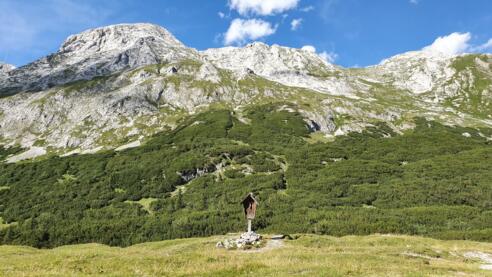
15 km - Reach the Hochalm saddle - on the right there is a small wayside shrine. The path descends slightly. At the next fork keep LEFT and walk towards the Karwendelhaus.
15.9 km - Reach the Karwendelhaus.
Weitere Informationen
Refreshment Options
Falkenhütte
Ausrüstung
Always wear good walking boots with a robust sole, and take waterproofs with you. Take plenty of water with you (min. 1 litre) and don’t forget sunscreen!
Sicherheitshinweise
Today you may be walking past a few different areas where cows graze. Although generally very docile and used to walkers, keep your distance and never turn your back on a cow that is behaving strangely or aggressive. Be particularly vigilant around cows with calves.
Always allow plenty of time for your hike. The walking times indicated do not include breaks. Breaks for photos and a rest need to be added to the specified times.
Make sure you find out about current weather conditions and keep an eye on weather changes. Thunderstorms can gather very quickly in the Alps.
Do not leave the designated hiking trails!


