| Schwierigkeit |
mittel
|
|
Aufstieg
|
486 hm |
|
Abstieg
|
996 hm |
| Tiefster Punkt | 665 m |
| Höchster Punkt | 1468 m |
|
Dauer
|
6:30 h |
|
Strecke
|
15,5 km |
Walk to Scheffau
Die Tour
Starting from the Kaiserlift valley station in Kufstein, the walk takes you via the Hoheck, around the Wild Kaiser mountains, down to Lake Hintersteiner and finishes in Scheffau.
Start your walk with a nostalgic chairlift ride (pay on arrival, €11.00) with the Kaiserlift to enjoy fabulous views of the Kaiser mountains. Going past the welcoming lodges with the Wild Kaiser mountains in the background, you will reach the scenic Lake Hintersteiner and from there, walk down to the village of Scheffau.
Autorentipp
Refreshment Options:
2.9 km - Kaindlhütte
5.7 km - Wälleralm
Highlights:
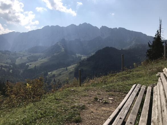
4.2 km - Hoheck summit cross – viewpoint
10.2 km - Swim at Lake Hintersteiner
Info
Karte
Details
|
Kondition
|
|
|
Erlebnis
|
|
|
Landschaft
|
|
| Technik |
Beste Jahreszeit
Wegbeschreibung
Start
Kaiserlift cable car station in Kufstein
Ziel
Church Square (Kirchplatz) in Scheffau
Weg
0.00 km - Start at the top station of the Kaiserlift, the lift behind you, diagonally STRAIGHT down the mountain (signposted Brentenjochalm)
0.50 km – At the junction follow the main path STRAIGHT AHEAD (signposted path 814 Kaindlhütte)
Attention: after about a kilometer you have to cross some streams that cross the path from the right. In bad weather possibly slippery.
1.80 km – Turn RIGHT at the junction (814 towards Kaindlhütte) and follow the path along the course of the stream.
2.0km – At the small wooden bridge you cross the stream TO RIGHT and then climb the path diagonally TO LEFT steeply uphill.
2.1km – at the alpine huts you cross the larger main path and continue STRAIGHT AHEAD on the trail across the pasture. (814 in the direction of Kaindlhütte) until you get back on the main path and continue to follow the signs Adlerweg/814 in the direction of Kaindlhütte
2.9km – You now pass the Kaindlhütte (refreshment stop) and a little later a small chapel, at the following crossroads you go STRAIGHT AHEAD and continue to follow the Adlerweg (direction Hoheck/Hintersteiner See)
3.2km – Follow the Adlerweg, which branches off from the main path as a narrow path behind the fence TO LEFT and follow the path always in the direction of the Hoheck summit cross
4.2km – At the Hohecker summit cross you reach the highest point of the day (1470m)
-- the short detour up to the cross and the viewpoint behind it is worth it. It's also a good place to rest.
4.2km – You then continue STRAIGHT AHEAD on the Adlerweg through the turnstile and from there always downhill. First slightly TO RIGHT, then sharply TO LEFT, then STRAIGHT through a wooded area and over pastures.
5.7km – You will now see the houses of the Walleralm (refreshment stop) Keep to the right and walk uphill along the trail RIGHT of the houses on the pasture slope.
6.1km – past the small summit cross on the right, it still goes along the slope, now downhill again.
6.4km – At the junction "Im Sattel" (signpost) follow the road (#45) STRAIGHT AHEAD further downhill towards Hintersteiner See. From here, always follow the signs for path 45.
9.2km – At the small settlement of Seespitz, the path joins a paved road. Turn LEFT here and walk left past the large barn. You can now see the Hintersteiner See in front of you. After the last house, walk along the road towards the lake and then turn RIGHT at the signpost Schiestl Ost.
9.6km – at the junction See West you go through the gate and then turn LEFT towards the lake.
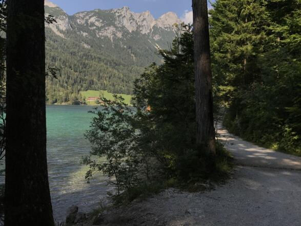
They now continue to walk STRAIGHT AHEAD until they reach the lakeshore. There they walk STRAIGHT AHEAD always along the shore, the lake on the left. They ignore paths that lead in from the right.
11.3km - The path moves away from the lake again and you reach a fork. Turn RIGHT here, away from the lake.
11.5km – a short time later, the path joins an asphalt road at the Greidern settlement. Follow this for a short distance uphill around the bend. At the next yellow signpost, turn LEFT, between the houses in the direction of Cafe Rosemarie.
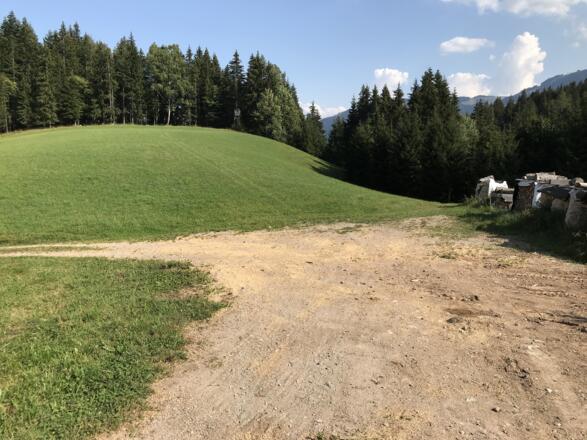
11.9km - see photo – The path makes a curve to the left here. But you walk STRAIGHT AHEAD across the meadow in the direction of the forest and then follow the forest path further downhill towards Scheffau/Cafe Rosemarie.
Follow the signs to trail 44 in the direction of Scheffau/Rosemarie
12.6km – Shortly after the forest, the path joins an asphalt road at some farm buildings, which they follow LEFT in serpentines down the mountain (still 44 Scheffau).
13.5km – The road leads through the settlement of Seebach. Continue to follow it without paying attention to the junctions in the village.
14.1km – The road forks at a stream. Turn RIGHT between the houses until you reach Cafe Rosemarie (refreshment stop).
14.2km – Opposite the café you leave the road and turn LEFT onto the gravel road towards Scheffau. On this they first cross the stream and then climb uphill in two serpentines. Then keep straight ahead and follow the path, which is soon paved again, in the direction of Scheffau. At the same time, you always have a view of the Kaiser Mountains on the left.
15.5 km – You reach the entrance to Scheffau, turn RIGHT in front of the church and immediately turn LEFT again to come to the village square Scheffau. At the village square (bus stop and tourist information) turn RIGHT and follow the main road downhill for a while.
16.0 km - At four coloured pillars on the road (entrance to the Kneipp/barefoot path). TURN LEFT into the forest and after about 100m turn RIGHT on the forest path. Follow the forest path downhill until you reach the road again. There turn LEFT and follow the road.
16.5 km - You have arrived at today's destination, the Gasthof Wilder Kaiser.
Anreise
Öffentliche Verkehrsmittel
Today starts with a ride on the ‘Kaiserlift’ chair lift. From the centre of Kufstein take the bus no. 1 from ‘Oberer Stadtplatz’ in the direction of ‘Ebbs Kaisertal’ and alight at Meraner Strasse. The journey takes about 6 minutes. The Kaiser lift is open from (08.30 – 16.30) and costs approx. 11 euros.
Alternatively, you can walk the 2km from the centre of Kufstein to the chairlift. In this case, please follow our description here: https://your.macsadventure.com/en/tour/hiking-trail/kufstein-to-the-kaiser-lift/37267660/
Take the Kaiser Lift to the Bergstation, where you begin today's hike.
Weitere Informationen
Kufstein Fortress
First documented in 1205 as a possession of the Bavarian Duke Ludwig and the Bishop of Regensburg, Kufstein Fortress is today one of the most attractive tourist destinations in the Tyrolean lowlands. A series of 21 information boards will guide you round this impressive open-air complex and its fortifications, including the Elisabeth battery with its vast cannons, as well as the castle courtyard known as the “Schlossrondell”.
Kaiserlift
A delightful 20-minute journey on the nostalgic Kaiserlift chair-lift takes you up to the Brentenjoch top station at 1,200 metres. More information can be found here.
Hinterseinersee
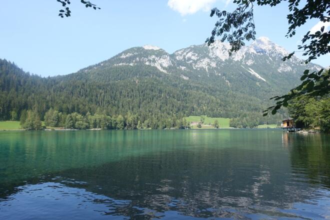
Covering 56 hectares and reaching a depth of up to 36 metres, Hintersteiner Lake is one of the cleanest and most beautiful mountain lakes in Tyrol, making it the perfect spot for a quick cooling dip. A small bathing lido and café on the south bank are open from the beginning of May to the end of September, weather permitting. A number of small gravel islands along the hiking trail provide an ideal jumping-off point into the cool water.
Ausrüstung
In fine weather: Take swimwear and a towel if you fancy a refreshing dip in Lake Hintersteiner.
Always wear good walking boots with a robust sole, and take waterproofs with you. Take plenty of water with you (min. 1 litre) and don’t forget sunscreen!
Sicherheitshinweise
Today you may be walking past a few different areas where cows graze. Although generally very docile and used to walkers, keep your distance and never turn your back on a cow that is behaving strangely or aggressive. Be particularly vigilant around cows with calves.
Always allow plenty of time for your hike. The specified walking times only refer to actual time spent walking. Breaks for photos and a rest need to be added to the specified times.
Make sure you find out about current weather conditions and keep an eye on weather changes. Thunderstorms can gather very quickly in the Alps.
Do not leave the designated hiking trails!


