| Schwierigkeit |
mittel
|
|
Aufstieg
|
446 hm |
|
Abstieg
|
793 hm |
| Tiefster Punkt | 1154 m |
| Höchster Punkt | 1831 m |
|
Dauer
|
4:15 h |
|
Strecke
|
10,4 km |
Walk to Längenfeld
Die Tour
Enjoy descending on mountain paths along the Ötztaler Ache, take in the beautiful views as you go.
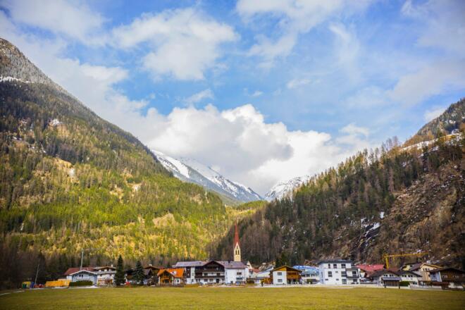
A shorter day of walking takes you from Niederthai over green pastures and through airy forests further down into the Ötztal Valley. Stop along the way for an al fresco picnic of local meats and regional produced Mozzarella. Descend to Längenfeld, the main town of the lower Ötztal
Autorentipp
After your walking day relax your tired legs in the warm healing waters of the impressive ‘Aqua Dome’ spa and wellness centre.
Info
Karte
Details
|
Kondition
|
|
|
Erlebnis
|
|
|
Landschaft
|
Beste Jahreszeit
Wegbeschreibung
Start
Tourist Information Niederthai
Ziel
Church of Längenfeld
Weg
0.0 km – With the Tourist Information Office behind you, TURN RIGHT and walk up the paved road. Follow the signs to the district of Ennebach/district Überfeld.
0.3 km – At the fork in the road at the Hotel Falknerhof, KEEP RIGHT and go STRAIGHT through the village. In the district of Überfeld you will pass a fountain on your right.
1.1 km – At the junction with Marterl TURN LEFT onto a gravel road. Follow the signs to Hemerach-Alm and the red and white markings of the Ötztaler Urweg. Go STRAIGHT through the gate and KEEP RIGHT along the sports field.
1.8 km – At the junction after the viewpoint with benches, go STRAIGHT AHEAD onto the gravel road. Follow the signs to Wiesle/Längenfeld/Hemerachalm and follow the red and white markings of the Ötztaler Urweg until further notice. Ignore the path to the left towards Hemerkogel and other branching paths to the right and left.
2.6 km – At the junction with the spring, TURN LEFT onto a rooty hiking trail. When wet, it can be slippery here. Follow the signs to Hemerachalm. On the trees you will see red-white-red markings.
3.3 km – In a large clearing with several huts, continue STRAIGHT. Here you have reached the highest point of today's stage. The path now becomes a meadow path marked "white dot with red border".
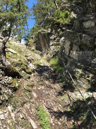
4.1 km – You will pass the first of four wire rope secured points.
5.0 km – At the small junction TURN RIGHT. Follow the signs to Dorf, the red and white marking of the Ötztaler Urweg all the way down to the valley. Do not cross the creek. When you reach the gravel road, you have already walked past the junction.
5.9 km – At the T-junction in the valley, TURN LEFT and walk parallel to the main road. After a few meters you will cross a stream.
6.2 km – At the next intersection, TURN RIGHT and go through the underpass of the main road. After that, TURN RIGHT.
6.6 km – At the crossroads at the chapel, TURN LEFT towards Dorfer Au and walk STRAIGHT AHEAD until you reach the edge of the forest by the river.
7.2 km – At the junction at the edge of the forest in front of the river bank, TURN LEFT onto the gravel road and walk parallel to the river. This will remain on your right side. Follow the signs to Längenfeld.
8.8 km – At the wood chip power plant, cross the main road and continue STRAIGHT on the paved road parallel to the river. At the next junction, KEEP RIGHT on the gravel bike path parallel to the river.
9.6 km – At the crossroads at the campsite, go STRAIGHT AHEAD until you reach the bridge in front of the thermal baths. Here the slides are easy to recognize. TURN LEFT before the bridge and walk STRAIGHT AHEAD until you reach the main road in Längenfeld.
10.4 km – Arriving at the main road, TURN RIGHT onto the footpath next to the main road and go to the church in Längenfeld.
10.5 km – You have reached the destination of today's stage, the parish church in Längenfeld.
Weitere Informationen
Ausrüstung
We recommend wearing hiking boots that are well broken-in, plus a rain jacket and waterproof trousers in wet weather, as well as taking sun cream and a hat on nicer days.
In your information pack, you’ll find a detailed list of all the required hiking gear, including some good hiking boots, appropriate clothing, a rain jacket and a backpack
Sicherheitshinweise
There are 4 sections today where the path has been secured with ropes, therefore you must be confident walking at heights and steady on your feet. In rainy weather, the narrow trails can be muddy and slippery. Make sure to wear sturdy footwear with good grip.
Check the latest weather information (for example by asking at your accommodation or the local tourist information centre) and be on the lookout for changes in the weather. If the weather is stormy or very rainy, do not walk this trail, as the path can be slippery.
You are responsible for your own safety. Know your limits and follow signs and instructions at all times. Off-track navigation is not recommended.


