| Schwierigkeit |
mittel
|
|
Aufstieg
|
856 hm |
|
Abstieg
|
52 hm |
| Tiefster Punkt | 958 m |
| Höchster Punkt | 1766 m |
|
Dauer
|
6:20 h |
|
Strecke
|
19,5 km |
Walk to Hallerangerhaus
Die Tour
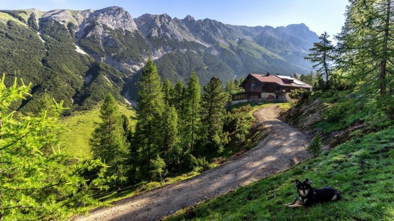
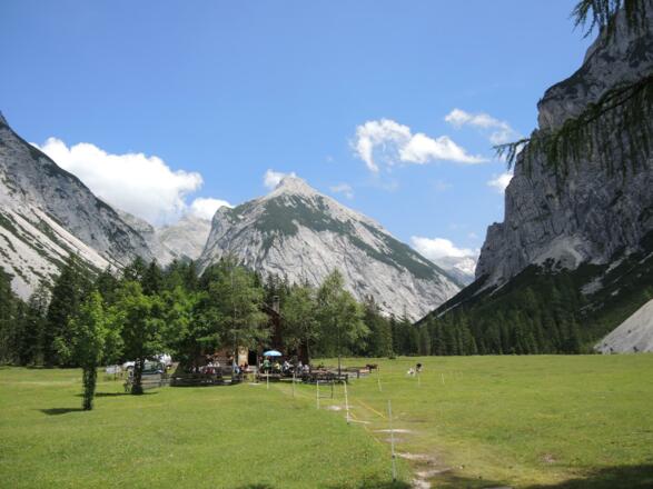
A hike from Wiesenhof Mountain Inn in the Hinterau Valley to Hallerangerhaus Mountain Hut.
In the morning, our hiker’s taxi will take you into the Hinterau Valley. Following a moderately ascending trail, you’ll trace the Isar river to its source. At Kastenalm Inn, you can recharge your batteries for the final ascent, which will take you further into the Karwendel mountain range. You’ll get to experience life as a true mountaineer as you spend the night in a shared dorm room at Hallerangerhaus Lodge.
Autorentipp
On warmer days, you can enjoy some beautiful breaks on the banks of the Isar and refresh your tired legs in the crystal-clear waters.
Info
Karte
Details
|
Kondition
|
|
|
Erlebnis
|
|
|
Landschaft
|
|
| Technik |
Beste Jahreszeit
Wegbeschreibung
Start
Isarlodge or Scharnitz Train Station
Ziel
Hallerangerhaus Lodge
Weg
Starting from the Isarlodge (Gasthof Wiesenhof):
0.0 km - You are standing on a wide gravel road. To your right is the Gasthof Wiesenhof below. Take the RIGHT road and follow the signs to the Halleranger Alm, Halleranger Haus and Pfeishütte.
1.9 km – The road reaches the track height, makes a right turn and you reach a crossroads. Here take the path that continues to the LEFT, continue in the direction of Halleranger Haus and follow this gravel road for another 10 km. Ignore all outgoing paths and paths.
11.8 km – You will reach the Kastenalm. Here the gravel road turns into a narrower hiking trail. This hiking trail takes you along the Lafatscher Bach to the Hallerangerhaus.
16.5 km – You have reached the Halleranger House.
Starting from Scharnitz train station (if you are hiking the Adlerweg and were accommodated in Mittenwald the night before):
Coming from the station building, go straight ahead to Hauptstraße (Innsbrucker Straße) and keep left.
0.46 km - Shortly before the bridge over the Isar, turn left and follow Inrainstraße.
0.86 km - Shortly before the next bridge, turn left again and continue along Inrainstraße parallel to the river.
1.3 km - At the next fork in the road, keep to the right and shortly afterwards you will reach a T-junction. At this point, turn left and follow Hinterautal Straße parallel to the Isar.
3.0 km - You are standing on a wide gravel road. To your right is the Gasthof Wiesenhof below. Take the RIGHT road and follow the signs to the Halleranger Alm, Halleranger Haus and Pfeishütte.
4.9 km – The road reaches the track height, makes a right turn and you reach a crossroads. Here take the path that continues to the LEFT, continue in the direction of Halleranger Haus and follow this gravel road for another 10 km. Ignore all outgoing paths and paths.
14.8 km – You will reach the Kastenalm. Here the gravel road turns into a narrower hiking trail. This hiking trail takes you along the Lafatscher Bach to the Hallerangerhaus.
19.5 km – You have reached the Halleranger House.
Weitere Informationen
Refreshment Options
Gasthaus Wiesenhof Mountain Inn
Karwendal Alpine Park
The Karwendel Alpine Park is the largest Nature Park in Austria and it comprises a total of 11 protected areas, the most famous of which is the Karwendel. More information on Karwendel Nature Park can be found at https://www.alpenwelt-karwendel.de/en
Ausrüstung
Always wear good walking boots with a robust sole, and take waterproofs with you. Take plenty of water with you (min. 1 litre) and don’t forget sunscreen!
Sicherheitshinweise
Today you may be walking past a few different areas where cows graze. Although generally very docile and used to walkers, keep your distance and never turn your back on a cow that is behaving strangely or aggressive. Be particularly vigilant around cows with calves.
Always allow plenty of time for your hike. The walking times indicated do not include breaks. Breaks for photos and a rest need to be added to the specified times.
Make sure you find out about current weather conditions and keep an eye on weather changes. Thunderstorms can gather very quickly in the Alps.
Do not leave the designated hiking trails!


