| Schwierigkeit |
mittel
|
|
Aufstieg
|
373 hm |
|
Abstieg
|
1358 hm |
| Tiefster Punkt | 782 m |
| Höchster Punkt | 2084 m |
|
Dauer
|
5:30 h |
|
Strecke
|
13,0 km |
Walk to Absams-Hall in Tyrol
Die Tour
A short ascent to Lafatscher Joch, followed by a long descent via St. Magdalena through the Halltal Valley to Gasthof Walderbrücke Inn in Absams from here you will be transferred to Hall.
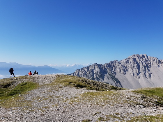
This is a spectacular route. Along steep cliffs, you’ll ascend to Lafatscher Joch, where you will be rewarded in good weather with amazing views of Großglocker Mountain. After a long descent through the Isstal Valley to St. Magdalena mountain lodge, you’ll arrive in an idyllic resting spot. Via an escape route you’ll continue downhill through the Halltal Valley to Gasthof Walderbrücke Inn.
You will be collected from here at 1530 by taxi and taken to your accommodation.
Info
Karte
Details
|
Kondition
|
|
|
Erlebnis
|
|
|
Landschaft
|
|
| Technik |
Beste Jahreszeit
Wegbeschreibung
Start
Hallerangerhaus Lodge (1,767 m)
Ziel
Walderbrücke Absams Inn
Weg
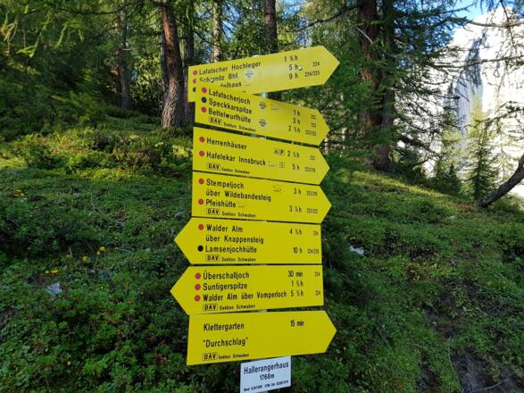
0.00km – With Hallerangerhaus Lodge behind you, walk towards the large Karwendel Naturpark display board. TURN RIGHT on the trail, which leads slightly uphill. Follow the signs for ‘Herrenhäuser’ and ‘Stempeljoch’. The path leads gently uphill at first through the pine trees, until you reach a steep uphill slope.
1.00km – About half way along the steep slope, the trail turns to the right and climbs less steeply through the pine trees and green mountain grasslands. FOLLOW THIS PATH ALL THE WAY. You’ll pass a crossroads with a beautiful view of the Karwendel mountains. Follow the now-widening path, ignoring all trails leading off to the side.
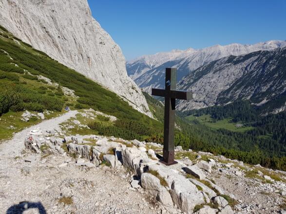
2.40km – You’ll reach Lafatscher Joch with a fantastic view. KEEP RIGHT here and follow trail signpost #223 towards Issanger/Issjöchl/Herrenhäuser. The path will lead you downhill. Ignore all paths that fork off the trail and continue following route #223. The path will become increasingly stony and zig-zags in a downhill fashion.
4.8km – You’ll reach the Issanger crossroads. This is a good place to rest under the shade of the trees. You have 2 options, either continue following route #233 on the stony hiking trail via Issjöchl, the salt mines and manor houses, or turn left and take the shorter route (not numbered) towards St. Magdalena/Hirschbadsteig.
Continuing on route #223, head towards Issjöchl/Herrenhäuser: WALK STRAIGHT AHEAD and follow the widening path slightly uphill through the shady forest.
5.5km – You’ll reach the Issjöchl forest trail crossroads. KEEP RIGHT towards Herrenhäuser. The trail now leads slightly downhill and you’ll pass an old salt works on your way. Ignore all trails leading off to the sides. Continue straight ahead until the path turns left on itself in a zig-zag fashion and continue on the trail.
6.9km – You’ll reach the abandoned manor houses. Continue STRAIGHT AHEAD on this path past the houses.
8.00km - The path will turn onto a tarmacked road. Stay on this road for around 100 metres.
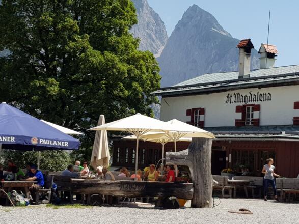
8.10km – TURN RIGHT onto a gravel path towards St. Magdalena. After around 800 metres, you’ll reach St. Magdalena mountain lodge.
To go further down into the valley, go LEFT around the building and past the restaurant terrace. Look out for a barely legible wooden sign on a tree by a bench with ‘Fluchtsteig’ [escape route] written on it .
Warning: when wet, this escape route is very slippery and difficult to walk on. We therefore recommend following the road down into the valley in wet weather.
WALK TO THE RIGHT at the tree onto a narrow path over the meadow and then into the forest. Follow the well-marked path downhill.
9.2km - The trail will lead along a steep cliff above a road, occasionally leading you very steeply downhill. Stay focussed and proceed with caution.
10.00km – You’ll see the roof of a building below to your left. Here, you can change from the path to a tarmac road. If you want to stay on the escape route, follow the path at the same level.
At this point, the escape route becomes even more challenging, with steep sections and difficult terrain, plus some narrow, slightly exposed parts where you’ll need to be very focussed.
11.6km – The trail leads downhill towards a road. Opposite, you’ll see a floodgate. Here, TURN LEFT on the footpath that runs parallel to the road and follow it for around 800m.
12.1km – You’ll arrive at a crossroads in the forest. Turn HALF LEFT onto the slightly downhill trail (not signposted). Ignore the signs that say ‘Rußboden Rundwanderweg’ [hiking route]. Follow this trail for 500m.
12.5km – The trail will turn into a tarmac road. Shortly afterwards, you’ll see a bridge over the Weißenbach river. CROSS THE BRIDGE and then TURN RIGHT onto a footpath towards the Walderbrücke Inn.
13.1km – You have reached your destination for today, the Walderbrücke Inn in Absams. You will be collected from here at 1530 by taxi and taken to your accommodation.
Weitere Informationen
Food and Drink
Take enough water with you for the whole day. There are only a few places where you can access drinking water. There is a small drinking fountain for very thirsty travellers in an old chapel in one of the manor houses along the way.
Ausrüstung
Always wear good walking boots with a robust sole, and take waterproofs with you. Take plenty of water with you (min. 1 litre) and don’t forget sunscreen!
Sicherheitshinweise
Today you may be walking past a few different areas where cows graze. Although generally very docile and used to walkers, keep your distance and never turn your back on a cow that is behaving strangely or aggressive. Be particularly vigilant around cows with calves.
Always allow plenty of time for your hike. The walking times indicated do not include breaks. Breaks for photos and a rest need to be added to the specified times.
Make sure you find out about current weather conditions and keep an eye on weather changes. Thunderstorms can gather very quickly in the Alps.
Do not leave the designated hiking trails!
Please note there may be some discrepancies in distances given by different devices/software.
