| Schwierigkeit |
mittel
|
|
Aufstieg
|
122 hm |
|
Abstieg
|
176 hm |
| Tiefster Punkt | 534 m |
| Höchster Punkt | 710 m |
|
Dauer
|
5:30 h |
|
Strecke
|
19,7 km |
Starnberg to Herrsching
Die Tour
Stroll alongside pretty Maisinger Lake on your way to Andechs, where there is a lovely monastery and an excellent brewery. Continue to Herrsching, and catch the ferry to Dießen.
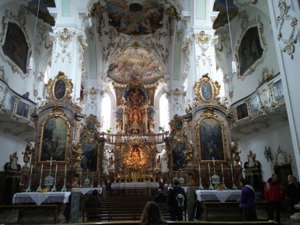
Most of today's walking is along paths and tracks through forests alongside streams. You will pass through open pastureland and some marshland outside of Maising. The grand Baroque church at Andechs and the ferry crossing on the elegant old boat from Herrsching to Diessen are perhaps the highlights of the day.
There are few shops on route to buy food and drink, other than at Starnberg and Herrsching. You would be well advised to fill your water bottle before leaving. There is an inn just outside Maising, and plenty of places to eat and drink at Andechs (as well as a brewery), and at Herrsching ferry pier.
Consult the ferry timetable (you will have been sent your ferry voucher and should present this on boarding or on request). For the latest timetables see www.seenschifffahrt.de/en/ammersee or call +49 8151 8061.
Info
Karte
Details
|
Kondition
|
|
|
Erlebnis
|
|
|
Landschaft
|
|
| Technik |
Weiter stöbern
Wegbeschreibung
Start
Starnberg
Ziel
Herrsching
Weg
Consult the ferry timetable (you will have been sent your ferry voucher and should present this on boarding or on request). For the latest timetables see www.seenschifffahrt.de/en/ammersee or call +49 8151 8061. Other services at Starnberg, Andechs, Hersching and Diessen.
0.00 km - After exiting Starnberg See Station on the lakeside you will see the ferry pier to your left.Facing the lake, TURN RIGHT and walk alongside the lake following the direction of the signpost on the way marker marked with a K (hereafter referred to as a K sign).Carry on to reach a railway bridge to your right.
0.40 km - TURN RIGHT and pass under the railway bridge (which is low, so watch out for your head) and continue uphill along Bahnhofstrasse.Continue to the 4-way crossing, where the road traffic turns to the left.
0.60 km - Go STRAIGHT ON uphill on Bahnhofstrasse. Continue to a crossroads controlled by traffic lights.
0.70 km - Go STRAIGHT ON over the traffic lights under the pedestrian bridge and carry on until you come to a turning on your left, Maising-Schucht Strasse.
1.30 km - TURN LEFT and walk along Maising-Schucht Strasse (following the K sign), which leads to a car park with a large house in front of you.
1.60 km - Go STRAIGHT ON, passing the big house on your left, along the path.Continue on this path alongside the stream through woodland, crossing from one side to the other on several occasions.Be sure to follow the K signs. Eventually the path takes you away from the stream to a road, where you enter the edge of Maising.
5.00 km - BEAR LEFT off the path onto the road, following the K sign to Maising. Continue to a T junction.
5.10 km - TURN RIGHT and walk on the road through Maising, over a stream and then uphill to a point where the road turns to the right.
5.60 km - Go STRAIGHT ON, leaving the road, and continue downhill along a path winding through fields. Carry on to reach a road.
6.20 km - TURN LEFT onto a road, following the K sign, passing an Inn to your right. The road then becomes more of a track, passing through forest and marshland.Then continue through fields to a 4-way crossing.
8.60 km -BEAR LEFT at the 4-way crossing, following the K sign to ‘Aschering 0.9K’. Carry on to a T junction.
9.40 km - TURN RIGHT alongside the stream to your left, in the village of Aschering, following the K sign to ‘Andechs 7.8K’.Carry on to a church on your right to reach a crossroads.
9.60 km - Go STRAIGHT ON over the crossroads along 'Bachweg' and cross a stream.
9.80 km - TURN RIGHT and carry on along the street beside a stream, to your right, to reach a fork in the road.
10.10 km - FORK RIGHT into 'Andechser Weg' and leave Aschering on a track through open fields.Carry on past turnings to the left and a shrine to the Virgin Mary to the right.Continue on the rack into a forest following the K signs until you come to a fork in the road.
11.50 km - FORK RIGHT, following the K sign to Andechs. Carry on to reach a T junction.
11.90 km - TURN LEFT onto a road, following the K sign to ‘Andechs 4.8K’ and ‘Herrsching 10K’.Continue to reach a path on the right.
12.10 km - TURN RIGHT onto a path, following the K sign to reach a track.
12.30 km - TURN RIGHT onto a track. Continue through farmland to reach the main road.
13.70 km - TURN LEFT and walk alongside the main road (to your right) on the cycle/footpath. Andechs is now clearly in view on the hill in front of you.Continue to a car park/layby on the other side of the road.
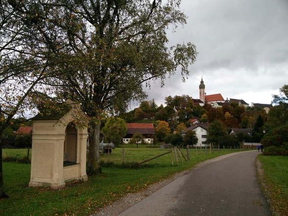
14.00 km - TURN RIGHT to cross the busy road (carefully) to reach a car park (K signs are missing here but this is what you must do).From the car park take the footpath going west towards Andechs (not the other one going east). Continue on the footpath. From here Stations of the Cross mark all the way to Andechs.
14.80 km - TURN RIGHT onto the road, just past the 12th Station of the Cross. Continue to St Elisabeth-Weg, to your left.
14.90 km - BEAR LEFT and continue on St Elisabeth-Weg, passing a car park on your right and then go over a crossroads.Then ascend the steep road to the brown/orange and white church tower of the monastery.
15.50 km - TURN LEFT, away from the church tower at the top of the hill and descend the steps, following the K sign, passing a crucifix on your way down.Carry on downhill on main path, ignoring other paths to right and left, following the K signs to Herrsching. The path widens to a track and descends to a T junction.
16.00 km - TURN RIGHT, following the K sign to ‘Herrsching 4.1K’. Continue on a dirt track through forest alongside a stream to your far left. Be sure to follow the K signs.The track gives way to an asphalt road with houses on either side as you enter Herrsching. You will then cross a small bridge and, just before coming to a second bridge you will see a turning to your left.
18.50 km - TURN LEFT and continue along Andechsstrasse, with a stream to your right. (There are no K signs from here to the ferry).Continue into Albertstrasse to then reach a busy road.
18.90 km - TURN LEFT and walk along the busy road of Muhlfelder Strasse to the traffic lights.
19.50 km - TURN RIGHT at the traffic lights and walk along Sees Strasse to the lake of Ammersee, where you will find the ferry pier in front of you.
19.70 km - ARRIVE at the Herrsching ferry pier. Please present your voucher (this has been sent to you) when requested.On disembarking at Diessen you will find directions to all of the town's hotels clearly signposted.
Weitere Informationen
This walk is part of the following itinerary:
WGSKLW1
Services : There are few shops on route to buy food and drink, other than at Starnberg and Herrsching. You would be well advised to fill your water flask before leaving. There is an Inn just outside Maising, and plenty of places to eat and drink at Andechs (as well as a brewery). There are also places to eat and drink at Herrsching near to the ferry pier.
Alternative Transport: Bus 951 from Starnberg via Andechs to Herrsching http://andechs.de/fileadmin/images-andechs/redakteur/service/docs/MVV_Starnberg_Andechs_Herrsching.pdf
Points of Interest:
Stations of the Cross on the way to Andechs.
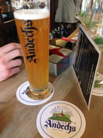
Benedictine Monastery, Church and Brewery at Andechs; founded in 1455, this is the oldest pilgrimage church in Bavaria. Andechs Monastery offers a fascinating view into the history of art, culture, architecture and pilgrimage in Bavaria, from the Late Middle Ages until today. Tel: +49 8152 3760, http://andechs.de/en/church-monastry/ guided tours of the church and brewery are available (book in advance – see http://andechs.de/en/guided-tours/)
Ausrüstung
A sturdy pair of walking trainers are adequate for this route if you don't wish to wear hiking boots.
Sicherheitshinweise
There are short sections of road walking, please take care when crossing the roads


