| Schwierigkeit |
mittel
|
|
Aufstieg
|
758 hm |
|
Abstieg
|
758 hm |
| Tiefster Punkt | 659 m |
| Höchster Punkt | 1366 m |
|
Dauer
|
5:30 h |
|
Strecke
|
15,0 km |
Loop Walk to Brennkopf
Die Tour
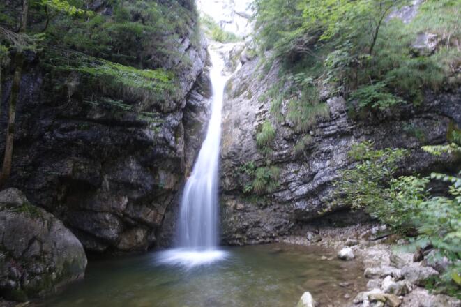
Stunning loop walk on the Breenkopf summit with a rest at a lodge. The route back takes in a few waterfalls with refreshing plunge pools.
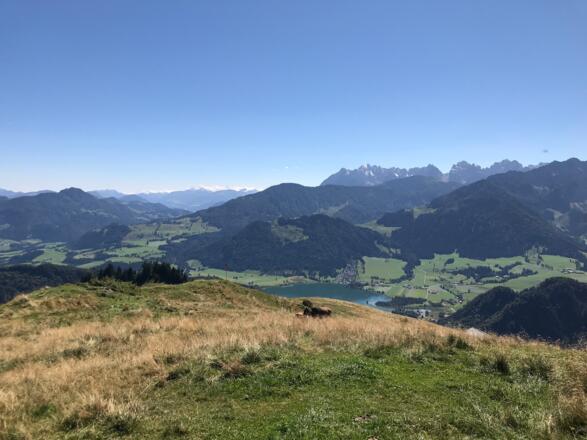
Today you have the chance to round off your walking tour with a hike up to the picturesque Brennkopf mountain. Reaching a height of just 1,355m above the village of Walchsee, the Brennkopf opens up unbeatable views of the magnificent alpine landscape around the Zahmer and Wilder Kaiser peaks. This route takes in a rest at a lodge and a waterfall with plunge pools. Be sure to take your swimming things so you can enjoy a refreshing dip in the waterfall or the Walchsee after your hike! Return to Durchholzen by bus.
Autorentipp
12.80 km - Stop off at the Burgeralm dairy and treat yourself to some delicious mountain cheese
13-17km – Several tiny hidden waterfalls with plunge pools
Info
Karte
Details
|
Kondition
|
|
|
Erlebnis
|
|
|
Landschaft
|
|
| Technik |
Beste Jahreszeit
Wegbeschreibung
Start
Walchsee village square
Ziel
Walchsee village square
Weg
The hike can be shortened by approx. 3 km by taking the bus from Durchholzen to Walchsee in the morning and only then joining the hike (timetable information under https://fahrplan.vvt.at). If you are accommodated in Walchsee Ort, walk to the entrance to the village at the bridge and start from there.
Directions starting in Durchholzen:
0.00 km – With your back to the Hotel Garni Tirol, turn RIGHT on the paved road Sonnleiten and follow it until it meets the B172 road. Turn LEFT there and follow the country road for a while.
1.7 km – Pass the SPAR market on the RIGHT at the entrance to the village.
2.0 km – Before the bridge, cross the main road and turn LEFT into the path that runs along the stream and follow the bank of the stream.
2.5 km – After the small wooded area, turn LEFT towards Schwaigs 1-20 and always follow the road along the alluvial area.
4.7 km – At the end of the alluvial plain, turn RIGHT at the small woodshed (signpost Rettenschöss/Schwaigs)
5.0 km – After the electricity pylon, turn LEFT in the direction of Brennkopf/Burgeralm (Wg 54)
5.2 km – At the fork at the next farm, turn RIGHT and follow path 54 in the direction of Brennkopf, past a golf course, now uphill.
6.0 km - A few hairpin bends after the golf course, walk STRAIGHT ahead from the main path at the signpost below the Kitzbichl Alm, past a barrier.
6.3 km - Before the path leads back into the forest via a ground gate, turn LEFT and follow the small path uphill across the meadow (signpost Hitscheralm) and continue through the forest.
6.7 km – After the gate, go steeply up the mountain TO the LEFT and then over the pastures in a few hairpin bends always uphill to the Hitscheralm.
8.1 km – At the Hitscheralm you pass RIGHT through the two wooden gates and turn RIGHT on the main path to follow it uphill past the upper alpine pasture building.
9.1 km – After the Hagerhütte, follow the signpost in the direction of Brennkopf/Burgeralm TO the LEFT (path 54) and follow the path uphill towards the Brennkopf summit cross.
9.8 km – When you reach the summit of the Brennkopf, turn LEFT and follow the path over the ridge away from the Walchsee and Kaisergebirge.
10.3 km – At the signpost after the turnstile at the gate, turn RIGHT in the direction of Bürgeralm.
10.9 km – At the crossroads, turn RIGHT again and at the alpine huts of the Bergeralm. Optional detour to the Wandberg summit and Maria Hilf Chapel approx. 30 minutes.
11.3 km - It's worth stopping for a bite to eat at the Burgeralm. Then you pass in front of the terrace and always follow the path along the stream - towards the waterfall.
13.2 km - The trail turns into a wider forest path
14.1 km – After a bend to the right on the forest road, turn LEFT into the narrow path and follow the signpost towards the waterfall.
15.0 km – You will reach a wooden bridge. Continue STRAIGHT along the stream into the valley (do not cross the bridge).
15.6 km – At the Oberwinkel settlement, the path joins a road. Now follow the signs in the direction of Walchsee.
17.2 km – Shortly after entering the village of Walchsee, turn RIGHT in front of the large pasture and then turn LEFT again into Alleestraße in front of the organic cheese dairy. Follow this road until you reach the village square.
17.4 km – You reach the destination of the hike at the Dorfplatz bus stop opposite the tourist information office in Walchsee.
Anreise
Öffentliche Verkehrsmittel
Following the Loop hike around Brennkopf, your walk finishes at Walchsee. From here, you will take a bus back to Durchholzen. Take bus no. 4030 from Walchsee Dorfplatz (direction Kufstein Bahnhof) and alight at Walchsee Durchholzen. The journey time is around 4 minutes.
Weitere Informationen
Walchsee
Walchsee, with its lake and the many small villages that surround it, lies to the north of the Kaisergebirge mountains in the region of Kaiserwinkl. Set amid a breathtaking alpine landscape and with ample opportunities for swimming, hiking and excursions in Bavaria and the Tyrol, Walchsee is a much sought-after holiday destination. The border region between Bavaria and Austria has always been an important trading centre, as well as a smugglers’ paradise. As far back as the Bronze Age a trade route was established for transporting copper and bronze, and in the Middle Ages wine and salt. After the Second World War, this became a favourite route for smuggling cigarettes, coffee, rum, and even whole cheeses.
Waterfall
On hot days, a quick dip in the pool at the bottom of the Lochner waterfall is always an inviting prospect.
Alpine Dairies ('Alme')
Alpine dairies (e.g. the Burgeralm cheese dairy and the Walchsee organic cheese dairy). Situated 1,330m up among the lush green meadows of the Wandberg in the district of Rettenschöss in the Tyrolean region of Kaiserwinkl, the Burgeralm hut is a popular stop-off for hikers, families and mountainbikers with splendid panoramic views of the Kaisergebirge, Hohe Tauern and even the Grossglockner. The Walchsee organic cheese dairy, set up in 1904 as a cooperative by almost 100 local dairy farmers, also produces and sells excellent cheese. Don’t forget to pack some in your rucksack next time you need sustenance on a long hike!
Ausrüstung
Always wear good hiking boots with a robust sole, and take waterproofs with you. Drink plenty of fluid (min. 1 litre) and don’t forget sunscreen!
Sicherheitshinweise
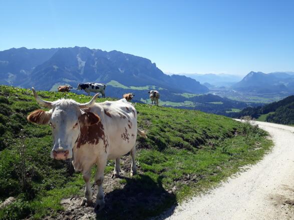
Today you may be walking past a few different areas where cows graze. Although generally very docile and used to walkers, keep your distance and never turn your back on a cow that is behaving strangely or aggressive. Be particularly vigilant around cows with calves.
Always allow plenty of time for your hike. Specified times are purely walking times. Breaks for photos and a rest need to be added on.
Make sure you find out about current weather conditions and keep an eye on weather changes. Thunderstorms can gather very quickly in the Alps.
Do not leave the designated hiking trails!


