| Schwierigkeit |
mittel
|
|
Aufstieg
|
772 hm |
|
Abstieg
|
703 hm |
| Tiefster Punkt | 591 m |
| Höchster Punkt | 970 m |
|
Dauer
|
4:00 h |
|
Strecke
|
13,7 km |
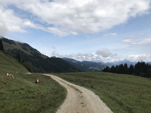
Loop Walk around Riedberg

Foto: Sarah Stone, Macs Adventure
Die Tour
A relaxing loop walk by Lake Walchsee across green meadows with options to stop for food.
Autorentipp
Refreshment Options:
8.30 km – Edernalm
10.00 km –Riedelalm
Info
Karte
Details
|
Kondition
|
|
|
Erlebnis
|
|
|
Landschaft
|
|
| Technik |
Beste Jahreszeit
Wegbeschreibung
Start
Dorfplatz, Walchsee
Ziel
Dorfplatz, Walchsee
Weg
0.00 km – Start from Dorfplatz bus stop opposite the tourist information centre in Walchsee. With the bus shelter and fountain behind you, HEAD LEFT along the main road.
0.30 km – Cross the street at Hotel Bellevue and continue along the main road.
0.70 km – At the beach café, HEAD RIGHT on the path at the lakeside.
0.90 km – At the end of the promenade on the shore at the small beer garden, GO LEFT for a short while to return to the main road and TURN RIGHT into ‘Am See’ street.
1.50 km – At the Nothegg holiday cottage, TURN LEFT and head towards the farm building. Follow the path between the houses.
2.10 km – Just after the riding school and the paddock, cross the main road and go STRAIGHT ON along the tarmac path towards Harau Alm/Ottenalm (route 48).
2.40 km – TURN LEFT at the sign towards the woods (route 48 towards Ottenalm/Josefskapellen).
Alternative: Follow the road straight on for 4.3 km.
2.50 km – At the first curve in the road, go STRAIGHT ON along the walking path (don't follow the road) and keep going on this narrow path by the stream.
2.90 km – Cross the wooden bridge ON THE RIGHT and follow the route past the first church. Go RIGHT past the second church and follow the stream uphill for a distance. After a few metres, cross the stream TO THE RIGHT and follow the wooden sign towards Haraualm.
3.00 km – At the junction to the main path, TURN RIGHT (towards Kössen) and follow this path into Tal.
4.30 km – At the junction, TURN LEFT and follow the road again.
5.30 km – At the crossing (sign: Gefährliche Kreuzung – hazardous crossing) TURN LEFT and follow the road between the two farm buildings uphill (Edernalm signposts).
6.30 km – Continue following the signpost towards Edernalm (do not go straight on towards Kössen)
6.70 km – At Glasalm, keep LEFT around the lodge and follow the red/white wooden markers towards the edge of the forest. Climb over the fence and follow the forest path steeply downhill.
6.80 km – At the fork in the stream, go RIGHT across the stream towards Gatterbrücke/Weide.
7.10 km – At the junction, TURN LEFT onto the gravel path towards Walchsee (trail 24)
8.30 km – Continue along the trail past Edernalm (refreshment option)
8.80 km – After the entrance to the gate at the barrier, keep LEFT (signpost to Walchsee).
9.50 km – Follow the trail past Tal an der Ottenalm (refreshment option). After the lodge, either around it or follow the small path STRAIGHT ON into Tal.
10.00 km – Go past Riedelalm (refreshment option).
11.60 km – TURN LEFT at the signpost towards ‘Walchsee über Forstmeile’ from the main past onto the narrow path into the forest. After a few metres, keep going uphill to the LEFT past the bench.
13.10 km – Back on the main road in Walchsee, TURN RIGHT.
13.30 km – You will reach Dorfplatz (village square) in Walchsee again – the destination for today's loop.
Weitere Informationen
Ausrüstung
Always wear good walking boots with a robust sole, and take waterproofs with you. Drink enough liquid (min. 1 litre) and don’t forget sunscreen!
Sicherheitshinweise
Always allow plenty of time for your hike. The specified walking times only refer to actual time spent walking. Breaks for photos and a rest need to be added to the specified times.
Make sure you find out about current weather conditions and keep an eye on weather changes. Thunderstorms can gather very quickly in the Alps.
Do not leave the designated hiking trails!
