|
Aufstieg
|
507 hm |
|
Abstieg
|
10 hm |
| Tiefster Punkt | 1894 m |
| Höchster Punkt | 2411 m |
|
Dauer
|
2:55 h |
|
Strecke
|
8,4 km |
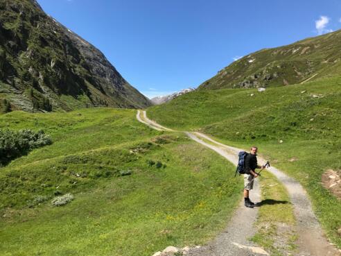
Bus to Vent and walk to Hochjoch Hospitz, cross the Rofental Valley

Foto: Minna Harshbarger, Macs Adventure
Die Tour
Today, you will divert from the standard E5 route. You will take the bus from Sölden to Vent. You will walk along the Rofental valley towards the Italian border and Hochjoch Hospitz.
In the morning, you will take the bus (line 8400) from Sölden to Vent. In Vent, you’ll walk from Hotel Similaun towards Hochjoch Hospitz Hostel.
Info
Karte
Wegbeschreibung
Start
Hotel Similaun Bus Stop
Ziel
Hochjoch Hospitz
Weg
From Sölden, take the bus to Vent; get off at the Hotel Similaun stop.
0.00 km - When you get off the bus, turn around so that the hotel is behind you. The bus stop for buses to Sölden is on your right. Walk straight on down the paved road and follow the road until it bends around to the right.
0.10 km - TURN LEFT; a sign for Spiegelbach will point you in the right direction. The road slopes downwards. The Rofenache glacial stream is on your right.
(PLEASE NOTE: If you do NOT want to cross the small suspension bridge, you should NOT turn left here. Instead, continue straight on and take the next left uphill. After approximately 100 metres, take a sharp left and follow the road [Rofenstraße] to Rofen.)
If you want to cross the suspension bridge, follow these directions:
0.20 km - Cross the bridge and follow the gravel path STRAIGHT AHEAD until you reach the Ochsenkopf lift, which will be on your left. To your left is the Niedertalbach river; to your right is the Rofenache glacial stream.
0.30 km - TURN RIGHT when you reach the Ochsenkopf lift and take the lower of the two gravel paths. Follow the yellow signs towards Rofen and the suspension bridge.
1.60 km - To your right is a cross and an information board on the Wildspitze mountain. Continue STRAIGHT AHEAD and follow the gravel path.
2.00 km - TURN RIGHT to access the suspension bridge. Cross the bridge and follow the path that slopes steeply upwards to the LEFT behind the suspension bridge.
2.10 km - To your right is a small chapel and a hotel. Keep RIGHT and then walk STRAIGHT AHEAD ascending the paved road. Once you reach the top, TURN LEFT and follow the wide gravel path one kilometre.
3.10 km - Cross the small bridge over the Mitterbach waterfall. Then continue STRAIGHT AHEAD on the gravel path.
3.60 km - Continue STRAIGHT ON on the gravel path. On your right is a sign for Vernagt Lodge. Ignore this path.
3.90 km - You will reach a goods cable lift. KEEP LEFT and follow the signs to Hochjoch Hospitz. The path now becomes narrower.
4.70 km - Come to a path equipped with wire ropes. Watch where you’re walking and hold on to the wire ropes. After one kilometre, you’ll reach another section with wire ropes.
6.10 km - Cross the bridge over the Vernagtbach stream.
8.40 km - You have reached Hochjoch Hospitz
Weitere Informationen
Find the bus timetable here: https://www.oebb.at/en/
You can get refreshments at the Hochjoch Hostel, however opening times can vary. Be sure to carry enough food to keep you going for the day!
Points of Interest
Suspension bridge near Rofen: This suspension bridge is relatively short, but has a metal grid walkway that allows you to look down, and sways when you walk across it. If you want to avoid the suspension bridge, take the direct road access route to Rofen from Vent.
Ausrüstung
Always wear good walking boots with a robust sole, and take waterproofs. Don’t forget to take plenty of water with you (at least two litres) and protect yourself against the sun. Trekking poles are recommended.
Sicherheitshinweise
Today you may be walking past a few different areas where cows graze. Although generally very docile and used to walkers, keep your distance and never turn your back on a cow that is behaving strangely or aggressive. Be particularly vigilant around cows with calves.
Always allow plenty of time for your hike. The walking times indicated do not include breaks. Rest and photo breaks must be added to the times indicated.
Check the latest weather information and be on the lookout for changes in the weather. Storms can develop rapidly in the Alps.
Do not leave the marked hiking trails.
