| Schwierigkeit |
mittel
|
|
Aufstieg
|
983 hm |
|
Abstieg
|
900 hm |
| Tiefster Punkt | 988 m |
| Höchster Punkt | 1971 m |
|
Dauer
|
6:00 h |
|
Strecke
|
14,3 km |
Bus to Spielmannsau, walk to Holzgau, transfer to Madau
Die Tour
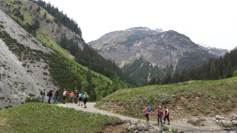
The first day of walking starts with a transfer to Spielmannsau. You will reach Holzgau in the Lechtal valley during the afternoon; from there, check if you are staying in Madau or Holzgau.
Route: Into the Lechtal via Kemptner Hut.
An early start is essential today.
Transfer to Spielmannsau (8.00 pick up from your hotel if you are staying in Sonthofen and 08:15 if you are staying in Hotel Explorer - Taxi Froriep Roman (+49 160 8549318)) or take the hiking bus to Spielmannsau (Wanderbus/Bergsteigerlinie – line 9753 or 8) from Oberstdorf bus station by 8:45 at the very latest (journey time of 20 minutes) to allow sufficient time for you to reach Holzgau during the afternoon. To avoid having to rush, the bus that departs at 7:45 would be an even better option.
If you are staying in Madau, you will need to take the bus departing from the parking lot in from of the Hotel Bären - check the timetable here: https://www.feuerstein-bus.at/linienverkehr (in 2022 the bus left at 16:15 and costs 17 Euros to be paid by cash)
(This does not apply to upgrade itineraries. If you have upgraded, you will stay overnight in Holzgau and be transferred by taxi to Madau at 08:15 the next morning).
Autorentipp
Make sure you start early today to ensure you reach the bus on time departing from Madau - On your ascent to Kemptner Lodge, pause to enjoy the view at the Marterl Knie shrine. Or sample some delicious 'Kaiserschmarren' pancakes – a delicious local delicacy – at Roßgumpenalpe Lodge.
***Important *** Bus from Holzgau to Madau - Since this service is used by a lot of E5 walkers, the shuttles fill up quickly. In case it’s full, Feuerstein sends another one. If you do not make it in time, you will have to call a taxi and pay the regular fare (Feuerstein is the only one permitted to drive up the toll road, so it’ll be the same company - Tel.: +43 (0) 5633 5633)
Info
Karte
Details
|
Kondition
|
|
|
Erlebnis
|
|
|
Landschaft
|
|
| Technik |
Beste Jahreszeit
Wegbeschreibung
Start
Spielmannsau (1,021m)
Ziel
Gasthof Bären, Holzgau
Weg
When you arrive in Holzgau in the Lechtal after the hike your day is not yet over. Call the taxi company as soon as you arrive in Holzgau to let them know what time you would like to travel (lead time approx. 20-30 min). No transfer will take place without telephone registration. If you are staying in Holzgau: Then a taxi is booked for you at 8:15 a.m. for the following morning, departure from the Hotel Bären car park. Leave your voucher with the driver.
Transfer to Spielmannsau (8.30 Pick up from your hotel) to start the walk.
0.0km - In Spielmannsau, turn your back to the hotel and head STRAIGHT ON down the paved road towards Trettach valley. On your right is a small playground. On your left is a wooden statue under a small roof.
0.90 km - Continue STRAIGHT ON and take the steep uphill right-hand path at the fork. You’ll see a sign for the Kemptner Lodge. Ignore the path that leads over a bridge 20 metres before on the right.
1.40 km - You will reach a gate and a small barn. This houses the goods cable lift to Kemptner Lodge. TURN RIGHT and follow the signs to Kemptner Lodge. You will now reach a wide footpath that will take you through the narrowing valley.
2.90 km - There is an information sign warning of falling rocks on your right. Walk through the passage as swiftly as you can. You will leave the hazardous area after 500 metres.
3.00 km- Cross the bridge on the RIGHT and climb the wooden steps.
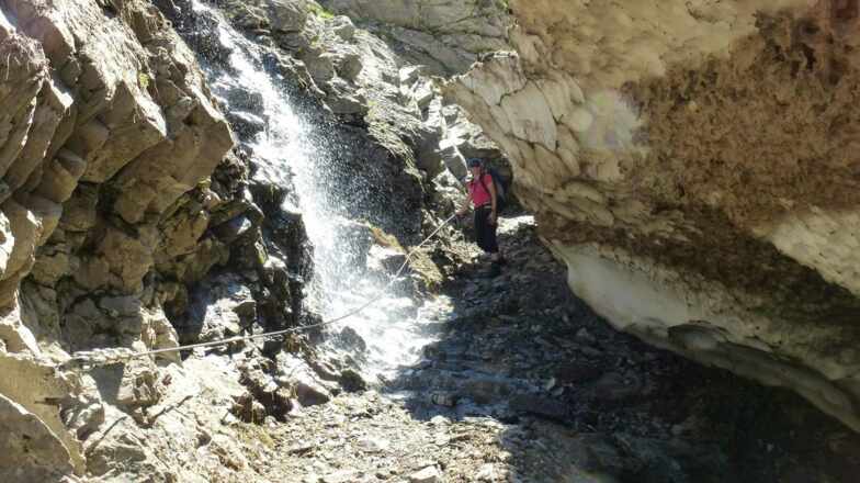
3.60 km- To your left is a viewing platform known as the “Marterl am Knie” shrine. Take a break here, or continue via the path to the right. You must now cross another bridge. Keep to the RIGHT and walk through the stream until you are back on the steep, narrow path. You have now reached Sperrbachtobel, which passes through a number of passages equipped with wire ropes over the next 2.5km.
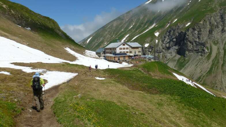
6.10 km- You have reached Kemptner Lodge! Take a break and enjoy the fantastic views. If you don’t want to go in, continue your walk by taking a sharp left onto a path that continues upwards. Follow the yellow signs to Holzgau via the Mädeljoch.
6.40 km - TURN RIGHT at the fork and continue straight on.
6.80 km - You will reach another fork. KEEP LEFT and follow signs for Holzgau.
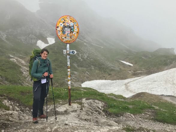
7.00 km - You’ve reached the Germany/Austria border at Mädeljoch. This is the highest point on today’s route. TURN LEFT and follow the yellow signs to Holzgau. The rocky path now slopes steeply downwards.
7.10 km - TURN RIGHT and follow the path down.
7.30 km - Continue STRAIGHT ON at the form and ignore the path that leads downwards to the left.
7.70 km - TURN LEFT and follow the path down. To your right is a red and white sign painted on stone.
9.30 km - TURN RIGHT at the junction. There is a fast-flowing river to your left.
9.70 km - KEEP RIGHT and follow the wide gravel path downwards.
10.10 km - Continue to follow the wide gravel path which now snakes down the slope.
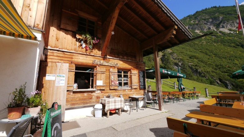
10.40 km - You have reached Roßgumpenalpe Lodge. Cross the patio, passing the benches, and continue STRAIGHT ON along the narrow downward path. The Roßgumpen waterfall is on your left.
10.50 km - TURN LEFT at the junction and cross the wooden bridge. Continue along the wide gravel path, which is a gentle downhill incline, for 2km, following the course of the Höhenbach river on your right.
12.40 km - Café Uta is on your left. You have two options at the fork: You can either walk across the suspension bridge to Holzgau, or opt for a route past the Simms waterfall. Both routes are marked with yellow signs. TURN LEFT and follow the lower path if you want to walk past the impressive Simms waterfall. Alternatively, TURN RIGHT and follow the path uphill if you prefer to cross the suspension bridge.
Route via Simms waterfall:
13.10 km - TURN RIGHT over the bridge.
14.00 km - You will see Holzgau village church up ahead of you. Follow the paved road STRAIGHT ON.
14.30 km - You are now approaching Gasthof Bären in Holzgau.
Take the bus from Hotel Bären car park, it has one departure time which you can see here: https://www.feuerstein-bus.at/linienverkehr
If you are staying in Holzgau: Then a taxi is booked for you at 8:15 a.m. for the following morning, a departure from the Hotel Bären car park. Leave your voucher with the driver.
If you are staying in Holzgau overnight, please check your accommodation list for the address.
If you find yourself with time to spare before your shuttle bus departs for Madau, walk down the road to the left then turn right. You’ll come out at the square in Holzgau, where you can enjoy a cup of coffee.
Anreise
Öffentliche Verkehrsmittel
Public transport
7:45 / 8:45 bus line 9763 or 8 Oberstdorf bus station – Spielmannsau, approx. 20 min., purchase tickets on the bus (approx. €4/pp) - https://www.rvo-bus.de/oberbayernbus/view/freizeittipps/wanderbusse/wanderbus-rva.shtml
16:15 Feuerstein taxi transfer from Holzgau to Madau. This taxi transfer has already been booked for you. Meet at 16:15 in the parking area in front of Hotel Bären in Holzgau. Please hand your voucher to the driver.
Important:
If you realise that you are going to be late for your 16:15 Madau taxi transfer, please let the transport company Feuerstein know in good time. You can then arrange a different transfer time directly with the company. You will need to pay the additional costs of the rebooked transfer when you travel.
Tel. Feuerstein transport company: +43 5633 5633
Weitere Informationen
Your hotel will be happy to provide a packed breakfast if you need to depart before breakfast is served. Just let the hotel reception know the evening before.
Transfer to the start point of the walk, in Spielmannsau. Alternatively take the bus from Hotel Explorer to Oberstdorf central bus station: (journey time 4 minutes): Bus 44 at 7:36, bus 67 at 08:19 or bus 44 at 8:30 From the station, the hiking bus (Wanderbus) departs for Spielmannsau at 7:45 and 8:45.
Points of Interest
Marterl am Knie shrine: An inviting rest area with outstanding views across the valley.
Sperrbachtobel: A steep 2.5-km long path to Kemptner Lodge along the Sperrbach stream. There are wire ropes along the sides of the trail. Hold on to the rope to your left to keep your balance when crossing the water.
Kemptner Lodge: This German Alpine Club lodge opened in 1891, and is located at an altitude of 1844 metres just before the Austrian border. You can purchase food and drinks at the lodge.
Lower Roßgumpenalm: This lodge is located adjacent to the Roßgumpen waterfall and is famous for its exceptional Kaiserschmarren pancakes.
Café Uta: This café is located at the trail fork where you decide whether to walk to Holzgau via the suspension bridge or along the Simms waterfall. Before you decide, you can enjoy something to eat or drink here.
Holzgau suspension bridge: The Holzgau im Lechtal suspension bridge is a 200-metre-long, 1.20-metre-wide and 110-metre-high rope suspension bridge. For a time, it was the longest and highest rope suspension bridge in Austria. The metal grid allows you to look down into the valley below – but don’t take this route if you’re scared of heights.
Simms waterfall: This impressive man-made waterfall was constructed in the 19th century.
Ausrüstung
Always wear good walking boots with a robust sole, and take waterproofs with you. Don’t forget to take plenty of water with you (at least two litres per person) and to protect yourself against the sun. Trekking poles are highly recommended.
Sicherheitshinweise
Today you may be walking past a few different areas where cows graze. Although generally very docile and used to walkers, keep your distance and never turn your back on a cow that is behaving strangely or aggressive. Be particularly vigilant around cows with calves.
Always allow plenty of time for your hike. The walking times indicated do not include breaks. Rest and photo breaks must be added to the times indicated.
Check the latest weather information and be on the lookout for changes in the weather. Storms can develop rapidly in the Alps. There may be snow on the passes at the beginning and end of the hiking season, be careful if it is wet the trail and be slippery.
Do not leave the marked hiking trails.
