| Schwierigkeit |
mittel
|
|
Aufstieg
|
377 hm |
|
Abstieg
|
303 hm |
| Tiefster Punkt | 684 m |
| Höchster Punkt | 1038 m |
|
Dauer
|
3:45 h |
|
Strecke
|
10,1 km |
Bus to Ötztal Bahnhof and walk to Oetz
Die Tour
The start of the Ötztaler Urweg takes you along the Ötztaler Ache and up the Auerklamm waterfall to some spectacular viewing points.
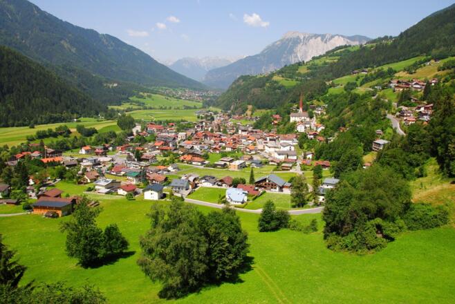
In the morning, you’ll take the bus to the Ötztal train station, the official starting point of the Ötztaler Urweg trail. You’ll walk parallel to the River Inn, climbing up to mountain hamlet of Oetzerau, situated at the entrance to the valley. Here you can take in the spectacular views of the valley, the 3000-metre summits looming over head and the route ahead of you. From Oetzerau, the trail descends at an easy-going pace to Oetz.
Autorentipp
The viewing point at the 6.0 km mark is a good place for a break and take in the great views of the waterfall.
Info
Karte
Details
|
Kondition
|
|
|
Erlebnis
|
|
|
Landschaft
|
Beste Jahreszeit
Wegbeschreibung
Start
Oetz
Ziel
Oetz
Weg
0.0 km – With the station building behind you, TURN RIGHT into Ambergstraße and follow the cycle path signs towards Oetz/Roppen.
0.3 km – At the fork in the road, KEEP LEFT and follow the cycle path markings on the road. At a sign post on the right you will see the red and white marking for the Ötztaler Urweg.
0.7 km – Turn RIGHT at the junction and follow the signs to Oetz and the red and white markings of the Ötztaler Urweg until further notice.
1.6 km – At a junction with red and white markings, turn left on a tree TURN LEFT onto a wooded path. Follow the signs to Brunau/Sautens/Oetz. Ignore the right-hand cycle path marking.
2.3 km – Once you arrive at the fence, go STRAIGHT through the open gate onto the paved road. Follow the road through the industrial area parallel to the river.
2.5 km – Under the bridge of the main road, go STRAIGHT across the parking lot along the river and follow the paved road.
3.3 km – At the wooden warehouse with gravel parking TURN RIGHT onto the gravel path along the riverbank. Follow the signs Brunau/Sautens/Oetz and the red and white markings of the Ötztaler Urweg. You pass a chapel in the village of Brunau and reach the main road.
4.6 km – On the main road, TURN RIGHT onto the footpath behind the crash barrier and follow the red and white markings of the Ötztaler Urweg to the entrance to Ambach.
5.2 km – At the zebra crossing, cross the main road and TURN RIGHT. Cross the parking lot. At the end of the parking lot, TURN LEFT. Follow the signs to Oetzer Au and the red and white markings of the Ötztaler Urweg.
5.4 km – At the dilapidated house on the right, TURN LEFT onto a rooty hiking trail steeply uphill. Follow the signs to the Auerklamm gorge and the red and white markings of the Ötztaler Urweg. You can see painted red and white markings on the trees.
6.6 km – At the next junction after the viewpoint, TURN RIGHT onto a rooty path. A few meters later you will see a stone and a tree with a red and white marking on the right.
6.8 km – After the bridge, KEEP RIGHT on the downhill path past the small chapel until you reach the houses. Walk STRAIGHT through the village on the main road. Ignore the signs to the right for the Auerklamm circular hiking trail.
7.3 km – At the fork in the road, KEEP RIGHT. Follow the signs to Oetz and the red and white markings of the Ötztaler Urweg. At the bus stop, cross the main road at the zebra crossing. Continue STRAIGHT AHEAD into the ascending street. After a few meters you will see the signs to Oetz on the right at a wooden barn. Until further notice, follow the signs to Oetz and the red and white markings of the Ötztaler Urweg.
9.2 km – At the junction before you reach the main road, TURN RIGHT onto a downhill meadow path. When you reach the main road, cross it very carefully. Attention: the curve is very difficult to see! TURN LEFT onto the downhill path. Follow the signs to Oetz and the red and white markings of the Ötztaler Urweg until you reach the houses.
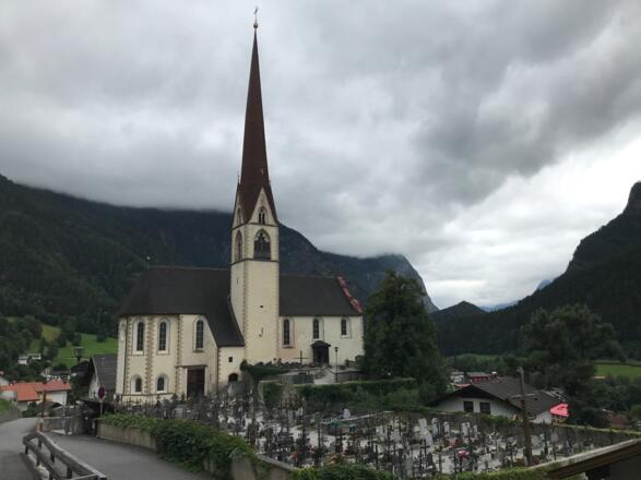
9.7 km – In front of the church, take a sharp RIGHT. Follow the signs to Oetz and the red and white markings of the Ötztaler Urweg.
9.9 km – At the T-junction TURN RIGHT and immediately LEFT again.
10.0 km – At a small park just before the main road, TURN LEFT. On the left hand side you will see the Tourist Information Office and the Post-Hotel Kassl.
10.1 km – At the tourist information office you have reached today's destination Oetz.
To get to the Hotel 3 Mohren, go to the main road and TURN RIGHT. After about 100 m you will find the hotel on the right-hand side.
Weitere Informationen
Ausrüstung
We recommend wearing hiking boots that are well broken-in, plus a rain jacket and waterproof trousers in wet weather, as well as taking sun cream and a hat on nicer days.
In your information pack, you’ll find a detailed list of all the required hiking gear, including some good hiking boots, appropriate clothing, a rain jacket and a backpack
Sicherheitshinweise
You must be confident walking at heights and steady on your feet. Concentrate on what you’re doing and keep your eyes on the path.
In rainy weather, the narrow trails can be muddy and slippery. Make sure to wear sturdy footwear with plenty of grip.
Check the latest weather information (for example by asking at your accommodation or the local tourist information centre) and be on the lookout for changes in the weather. If the weather is stormy or very rainy, do not walk this trail, as the path can be slippery.
You will also be crossing a few roads on today’s walk. Even if the roads are quiet, look out for cars when crossing.
You are responsible for your own safety. Know your limits and follow signs and instructions at all times. Off-track navigation is not recommended.


