| Schwierigkeit |
mittel
|
|
Aufstieg
|
422 hm |
|
Abstieg
|
461 hm |
| Tiefster Punkt | 415 m |
| Höchster Punkt | 634 m |
|
Dauer
|
4:50 h |
|
Strecke
|
64,9 km |
BT3 Stage 2 - Erding to Wasserburg am Inn
Info
Karte
Details
|
Kondition
|
|
|
Erlebnis
|
|
|
Landschaft
|
|
| Technik |
Wegbeschreibung
Start
Erdinger Weißbräu
Ziel
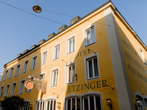
Wasserburg am Inn - Hotel Fletzinger
Weg
Summary: This route follows three main bicycle routes: Durchs Erdinger Land (DEL), Haager Land and the Inn Radweg West. The entire day is very well signed out.
Head south from the Erdinger Weißbräu guesthouse, passing the church and staying on the main road. Follow this until this road ends at a round-a-bout, and follow the DEL sign to the right through a neighborhood. Follow the signs to turn left at the big church and then left again following signs when this road ends. Eventually, this turns into a farm road. Turn left just before reaching the next road (not on the map) to follow a farm road through fields for a short distance before uniting with the main road on a bicycle path.
This bicycle path crosses a creek, and then turn right continuing to follow the DEL sign. Continue straight at a stop sign and continue to follow this road for a long distance until it ends at another road in Keckheim. Here, you'll notice the signs for your route change from a large DEL, to a smaller sign that says "Durchs Erdinger Land."
This road will eventually parallel the autobahn. You'll arrive at a fairly large road. Don't take the bicycle path on the left. Instead, you have to cross over the road and then immediately turn right onto a small farm road, signed out for Durchs Erdinger Land and Buch am Buchrain. This is a busy road right next to the autobahn on and off ramps, so use care when crossing it.
This farm road will take you over the autobahn and will shortly thereafter end at a larger, although not very busy, road. Turn left onto this road (at first without a bicycle path, but a path will come on the right side) and follow it into Buch am Buchrain. At Buch am Buchrain turn right on a small and lightly traveled road, following Durchs Erdinger Land signs. There is a turnoff marked for other bicycle routes, but Durchs Erdinger Land is not marked. Simply stay straight here, continuing to follow signs for Mittbach and Pemmering.
Just before Pemmering, you'll have a short but exhausting ascent into town. This is the start of more hilly terrain that you will remain in until Wasserburg am Inn.
In Pemmering, stay on the main road, following the Durchs Erdinger Land signs. When you meet a road, turn right and follow it past the maypole and then turn left following signs for Durchs Erdinger Land, pointed toward Haag i. OB (the road signs point toward Aich and Kremating). Turn left where this road ends onto a larger, but lightly traveled, road and enjoy the downhill. Turn right where that road ends following signs for Wernhardsberg and Lichtenweg. Turn left as signed out at Weiher and then continue to follow the bicycle route signs, turning right in Lichtenweg.
At Niesberg, turn left at a small chapel. Here, in Niesberg, you transition from following Durchs Erdinger Land signs to Haager Land signs.
Follow this road for a long time as you work your way eastward toward Haag. When you reach a large road, turn right onto the bicycle path and continue following signs for Haag. Just as you are coming into Haag (there is a Lidl grocery on your left), the bicycle route splits off to the right side of a wall into a neighborhood, parting from the main road. Here, you'll follow bicycle route signs through a neighborhood and up to a stately church before descending back down to the main road. If you are hungry and need a bakery or a butcher (butchers, or Metzger/ei, sell hot and fast dishes throughout the day), you can always stay straight on the main road and follow the bicycle route through town.
If you follow the bicycle route, after descending from the church, you'll meet a road with a sign to the right for Wasserburg am Inn. While this is your destination for the day, this route takes you on a bicycle path alongside a very busy and loud road that's not particularly enjoyable. However, the signed route to Wasserburg am Inn from Haag is much shorter and avoids the hilly terrain that awaits on the Inn Bicycle Trail, so it may be a good option for anybody who is tired.
Back to the intersection right after the church...turn left here (there are signs, you just have to look at your 8:00 to see them).
Go downhill to the main road and turn right, then take the next right and turn immediately left (ice cream shop at this intersection). Then, you'll pass the Unertl Brewery, which has a restaurant that makes a great lunch stop.
When you reach the small cluster of buildings at Anfelden, turn right and follow bicycle route signs on the farm roads (attention, one may be difficult to see behind a bush). When arriving at a road, cross it and continue following signs for Gars am Inn. When this road eventually ends, turn left, following signage for 1 km. to Gars am Inn.
When arriving in Gars am Inn, turn right on the main road, signs for Wasserburg am Inn and Haager Land. Take a right to follow the bicycle route and enjoy the descent down to the river. Just before the river, take a right turn following signs now for the Inn Radweg West and Wasserburg am Inn.
Upon arriving at the Inn River in Gars am Inn, transition from Haager Land to Inn Radweg West signs.
Note: it is possible to take the train from Gars am Inn to Wasserburg am Inn
You might be surprised that you almost immediately find yourself ascending away from the river. Follow this well-signed out route on a small road and then eventually onto a smaller, gravel section. A challenging rollercoaster section awaits where you'll have a series of descents, followed by steep ascents. It may be necessary to walk one or two of the ascents if you don't have enough momentum. At an unsigned intersection of five gravel paths, follow the one that curves uphill and around to the right.
Eventually, you'll arrive at a small cluster of buildings called Königswart, where you'll curve around to the left to head under the train bridge. This is followed by another unexpected ascent to a farm road, where you'll turn right, following signs for the Innradweg West. The bicycle route signs are very clear between here and Wasserburg am Inn, although in 2020 there were some detours in place, so pay more attention to the signage than to the map.
As you come into Wasserburg am Inn, continue following the trail along the river. Eventually, the bicycle path turns right onto a road and then left. You'll loop around the eastern edge of this river "peninsula." Where the road ends, turn right and then continue straight.
This stage ends at the turnoff for the Inn Bridge. We definitely recommend you take the turn and ride out onto the bridge for a perspective of the charming village you are staying in. If you are staying at Hotel Fletzinger Bräu, note that it comes before the end of this stage.


