| Schwierigkeit |
mittel
|
|
Aufstieg
|
1181 hm |
|
Abstieg
|
628 hm |
| Tiefster Punkt | 1348 m |
| Höchster Punkt | 2243 m |
|
Dauer
|
7:10 h |
|
Strecke
|
18,8 km |
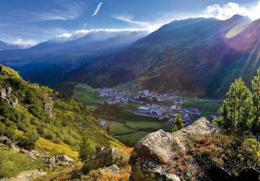
Alternative Walk - Solden to Obergurgl

Foto: Minna Harshbarger, Macs Adventure
Die Tour
Alternative route from Sölden to Obergurgl due to the closure on Timmesljochstraße.
This alternative route takes you from Sölden past the Sahnestüber, through the beautiful Kühtain Gorge to Zwieselstein and along the E5.
Autorentipp
This hike can be shortened if necessary.
There is a bus to Obergurgl from the Timmeljoch toll booth which goes four times daily. (it shortens the day by 9km, 900m altitude difference, approx. 3.5 hours). You can also shorten the walk at the start of your day by taking the shuttle bus from Sölden to the Sahnestüberl Hut (shortens the walk by 9km, 650m altitude difference, 3.5 hours).
The restaurant at the toll station is open daily from 10 a.m. to 4 p.m.
Info
Karte
Details
|
Kondition
|
|
|
Erlebnis
|
|
|
Landschaft
|
Beste Jahreszeit
Wegbeschreibung
Start
Sölden
Ziel
Obergurgl
Weg
This alternative route takes you from Sölden through the beautiful Kühtain Gorge to Zwieselstein and along the E5. Instead of turning off in the direction of Obergurgl and Sahenstüberl, continue ascending until you come to a junction in the direction of Timmelsjochstraße.
You walk a bit along the road to the Timmelsjoch smugglers' monument. Here you cross the Timmelsjoch High Alpine Road and hike downhill again parallel to the road. At the junction of a trail, keep left and hike over the Windegg slope to the Top Mountain Crosspoint. After the Top Mountain Crosspoint you reach Hochgurgl and finally Obergurgl.
Weitere Informationen
Sicherheitshinweise
Watch the short term local weather forecasts. Avoid high altitude hiking when the weather is bad. There are plenty of trails in the valleys, that allow you to reach a village quickly if bad weather sets in.
